
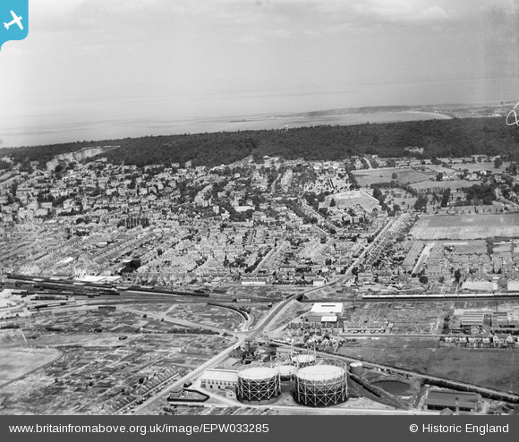
EPW033285 ENGLAND (1930). The town and Worlebury Hill, Weston-Super-Mare, from the south-east, 1930
© Copyright OpenStreetMap contributors and licensed by the OpenStreetMap Foundation. 2024. Cartography is licensed as CC BY-SA.
Nearby Images (3)
EPW033285

EPW033283

EPW001031

Details
| Title | [EPW033285] The town and Worlebury Hill, Weston-Super-Mare, from the south-east, 1930 |
| Reference | EPW033285 |
| Date | July-1930 |
| Link | |
| Place name | WESTON-SUPER-MARE |
| Parish | WESTON-SUPER-MARE |
| District | |
| Country | ENGLAND |
| Easting / Northing | 332702, 161007 |
| Longitude / Latitude | -2.9663342346165, 51.343656816063 |
| National Grid Reference | ST327610 |
Pins
 Nigel Loui |
Saturday 2nd of November 2013 04:34:50 PM | |
 Class31 |
Wednesday 6th of March 2013 09:17:57 PM | |
MB |
Sunday 13th of January 2013 11:08:02 AM | |
MB |
Sunday 13th of January 2013 11:07:16 AM | |
MB |
Sunday 13th of January 2013 11:04:38 AM | |
MB |
Sunday 13th of January 2013 11:04:11 AM | |
MB |
Sunday 13th of January 2013 11:03:15 AM | |
MB |
Sunday 13th of January 2013 11:01:32 AM | |
MB |
Sunday 13th of January 2013 11:00:35 AM | |
MB |
Sunday 13th of January 2013 11:00:01 AM | |
MB |
Sunday 13th of January 2013 10:57:05 AM | |
MB |
Sunday 13th of January 2013 10:53:14 AM | |
MB |
Sunday 13th of January 2013 10:49:43 AM | |
MB |
Sunday 13th of January 2013 10:49:20 AM |