
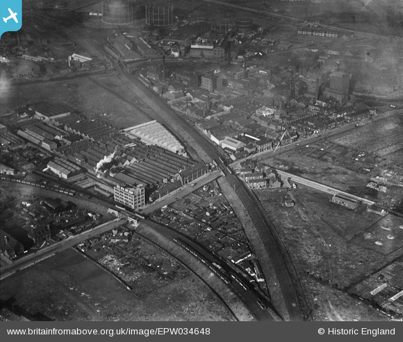
EPW034648 ENGLAND (1930). Stoneferry Canister Works, Kingston upon Hull, 1930
© Copyright OpenStreetMap contributors and licensed by the OpenStreetMap Foundation. 2024. Cartography is licensed as CC BY-SA.
Nearby Images (11)
EPW034648

EPW034661

EPW036517

EPW034657

EPW036518

EPW036516

EPW034649

EPW034652

EPW034656

EPW034650

EPW047920

Details
| Title | [EPW034648] Stoneferry Canister Works, Kingston upon Hull, 1930 |
| Reference | EPW034648 |
| Date | 16-October-1930 |
| Link | |
| Place name | KINGSTON UPON HULL |
| Parish | |
| District | |
| Country | ENGLAND |
| Easting / Northing | 510269, 430746 |
| Longitude / Latitude | -0.32710328525305, 53.761162970294 |
| National Grid Reference | TA103307 |
Pins
 John Wass |
Monday 25th of May 2015 03:59:59 PM |