
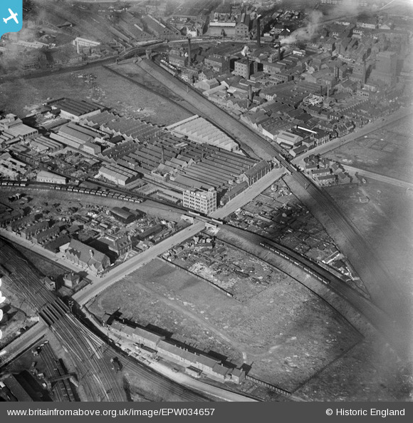
EPW034657 ENGLAND (1930). Stoneferry Canister Works, Kingston upon Hull, 1930
© Copyright OpenStreetMap contributors and licensed by the OpenStreetMap Foundation. 2024. Cartography is licensed as CC BY-SA.
Nearby Images (9)
EPW034657

EPW036517

EPW034649

EPW034661

EPW036516

EPW036518

EPW034648

EPW034652

EPW034650

Details
| Title | [EPW034657] Stoneferry Canister Works, Kingston upon Hull, 1930 |
| Reference | EPW034657 |
| Date | 16-October-1930 |
| Link | |
| Place name | KINGSTON UPON HULL |
| Parish | |
| District | |
| Country | ENGLAND |
| Easting / Northing | 510293, 430658 |
| Longitude / Latitude | -0.3267707911171, 53.760367189431 |
| National Grid Reference | TA103307 |
Pins
 John Wass |
Tuesday 12th of July 2016 08:55:20 PM | |
John Wass |
Monday 25th of May 2015 04:19:00 PM | |
John Wass |
Tuesday 19th of August 2014 02:58:38 PM |