
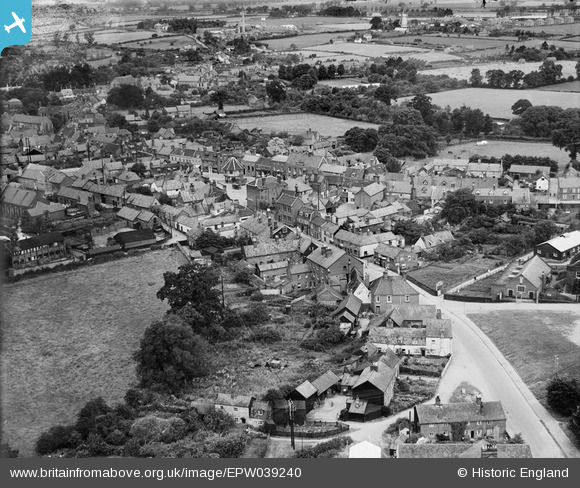
EPW039240 ENGLAND (1932). Fairland Street and the town centre, Wymondham, 1932
© Copyright OpenStreetMap contributors and licensed by the OpenStreetMap Foundation. 2024. Cartography is licensed as CC BY-SA.
Nearby Images (4)
EPW039240

EPW039241

EPW021446

EPW021568

Details
| Title | [EPW039240] Fairland Street and the town centre, Wymondham, 1932 |
| Reference | EPW039240 |
| Date | July-1932 |
| Link | |
| Place name | WYMONDHAM |
| Parish | WYMONDHAM |
| District | |
| Country | ENGLAND |
| Easting / Northing | 611126, 301404 |
| Longitude / Latitude | 1.1157253689559, 52.569058570941 |
| National Grid Reference | TG111014 |
Pins
 SteveCBR |
Monday 4th of September 2023 10:29:15 AM | |
SteveCBR |
Monday 4th of September 2023 10:28:47 AM | |
SteveCBR |
Monday 4th of September 2023 10:26:52 AM | |
SteveCBR |
Monday 4th of September 2023 10:24:57 AM | |
John W |
Sunday 26th of April 2020 09:51:36 PM | |
derbyminer |
Monday 22nd of September 2014 08:38:54 PM | |
derbyminer |
Monday 22nd of September 2014 08:38:01 PM | |
derbyminer |
Monday 22nd of September 2014 08:37:21 PM |