
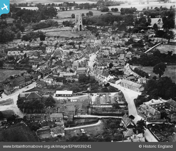
EPW039241 ENGLAND (1932). The town centre, Wymondham, 1932. This image has been produced from a copy-negative.
© Copyright OpenStreetMap contributors and licensed by the OpenStreetMap Foundation. 2024. Cartography is licensed as CC BY-SA.
Nearby Images (4)
EPW039241

EPW039240

EPW021446

EPW021568

Details
| Title | [EPW039241] The town centre, Wymondham, 1932. This image has been produced from a copy-negative. |
| Reference | EPW039241 |
| Date | July-1932 |
| Link | |
| Place name | WYMONDHAM |
| Parish | WYMONDHAM |
| District | |
| Country | ENGLAND |
| Easting / Northing | 611143, 301463 |
| Longitude / Latitude | 1.1160134247926, 52.56958165019 |
| National Grid Reference | TG111015 |
Pins
Be the first to add a comment to this image!