
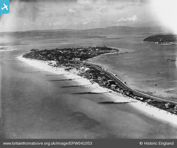
EPW041053 ENGLAND (1933). The Sandbanks peninsula, Sandbanks, from the east, 1933. This image has been produced from a copy-negative.
© Copyright OpenStreetMap contributors and licensed by the OpenStreetMap Foundation. 2024. Cartography is licensed as CC BY-SA.
Nearby Images (7)
EPW041053

EPW061366

EPW061370

EPW061365

EPW061368

EPW061367

EPW061369

Details
| Title | [EPW041053] The Sandbanks peninsula, Sandbanks, from the east, 1933. This image has been produced from a copy-negative. |
| Reference | EPW041053 |
| Date | April-1933 |
| Link | |
| Place name | SANDBANKS |
| Parish | |
| District | |
| Country | ENGLAND |
| Easting / Northing | 404791, 87694 |
| Longitude / Latitude | -1.9321694828603, 50.688300533626 |
| National Grid Reference | SZ048877 |
Pins
Be the first to add a comment to this image!