
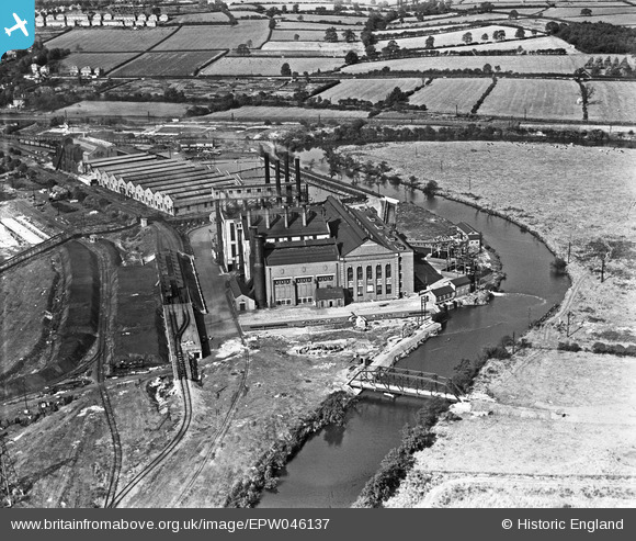
EPW046137 ENGLAND (1934). The Nottingham and Derby Power Company Spondon Power Station, Spondon, 1934
© Copyright OpenStreetMap contributors and licensed by the OpenStreetMap Foundation. 2024. Cartography is licensed as CC BY-SA.
Nearby Images (7)
EPW046137

EPW046133

EPW046136

EPW046138

EPW046134

EPW046135

EPW046132

Details
| Title | [EPW046137] The Nottingham and Derby Power Company Spondon Power Station, Spondon, 1934 |
| Reference | EPW046137 |
| Date | September-1934 |
| Link | |
| Place name | SPONDON |
| Parish | |
| District | |
| Country | ENGLAND |
| Easting / Northing | 440484, 334415 |
| Longitude / Latitude | -1.3980098625456, 52.905323423958 |
| National Grid Reference | SK405344 |
Pins
 Triggy |
Monday 10th of February 2014 12:03:27 PM | |
Triggy |
Monday 10th of February 2014 12:01:14 PM | |
Triggy |
Monday 10th of February 2014 12:00:02 PM | |
Triggy |
Monday 10th of February 2014 11:59:10 AM | |
Triggy |
Monday 10th of February 2014 11:58:14 AM | |
Triggy |
Monday 10th of February 2014 11:56:29 AM | |
Triggy |
Monday 13th of January 2014 09:52:22 PM |