
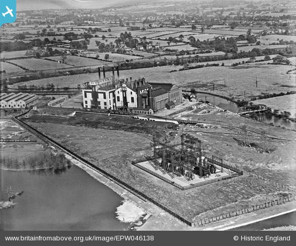
EPW046138 ENGLAND (1934). The Nottingham and Derby Power Company Spondon Power Station, Spondon, 1934
© Copyright OpenStreetMap contributors and licensed by the OpenStreetMap Foundation. 2024. Cartography is licensed as CC BY-SA.
Nearby Images (7)
EPW046138

EPW046134

EPW046135

EPW046137

EPW046133

EPW046136

EPW046132

Details
| Title | [EPW046138] The Nottingham and Derby Power Company Spondon Power Station, Spondon, 1934 |
| Reference | EPW046138 |
| Date | September-1934 |
| Link | |
| Place name | SPONDON |
| Parish | |
| District | |
| Country | ENGLAND |
| Easting / Northing | 440436, 334402 |
| Longitude / Latitude | -1.3987251894597, 52.905210170024 |
| National Grid Reference | SK404344 |
