
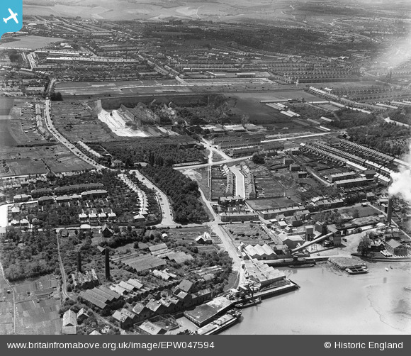
EPW047594 ENGLAND (1935). Gillingham Portland Cement Works and environs, Gillingham, 1935
© Copyright OpenStreetMap contributors and licensed by the OpenStreetMap Foundation. 2024. Cartography is licensed as CC BY-SA.
Nearby Images (6)
EPW047594

EPW047592

EPW047593

EPW047595

EPW047597

EPW047596

Details
| Title | [EPW047594] Gillingham Portland Cement Works and environs, Gillingham, 1935 |
| Reference | EPW047594 |
| Date | June-1935 |
| Link | |
| Place name | GILLINGHAM |
| Parish | |
| District | |
| Country | ENGLAND |
| Easting / Northing | 578872, 168743 |
| Longitude / Latitude | 0.57113038767457, 51.388999609121 |
| National Grid Reference | TQ789687 |
Pins
 Ian |
Thursday 26th of March 2015 10:29:27 AM | |
Ian |
Thursday 26th of March 2015 10:25:35 AM | |
 Dylan Moore |
Tuesday 7th of May 2013 03:53:54 PM | |
Dylan Moore |
Tuesday 7th of May 2013 03:53:22 PM | |
Dylan Moore |
Tuesday 7th of May 2013 03:52:22 PM | |
Dylan Moore |
Tuesday 7th of May 2013 03:51:49 PM | |
Dylan Moore |
Saturday 4th of May 2013 01:27:53 AM | |
Dylan Moore |
Saturday 4th of May 2013 01:26:03 AM | |
Dylan Moore |
Saturday 4th of May 2013 01:25:18 AM | |
Dylan Moore |
Saturday 4th of May 2013 01:24:31 AM | |
Dylan Moore |
Saturday 4th of May 2013 01:23:37 AM | |
Dylan Moore |
Saturday 4th of May 2013 01:22:45 AM | |
Dylan Moore |
Saturday 4th of May 2013 01:22:04 AM | |
Dylan Moore |
Saturday 4th of May 2013 01:21:38 AM |