
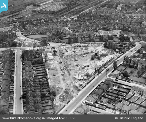
EPW056898 ENGLAND (1938). Construction of new housing by The Grange and Prout Grove, Dudden Hill, 1938
© Copyright OpenStreetMap contributors and licensed by the OpenStreetMap Foundation. 2024. Cartography is licensed as CC BY-SA.
Nearby Images (3)
EPW056898

EPW056897

EPW038702

Details
| Title | [EPW056898] Construction of new housing by The Grange and Prout Grove, Dudden Hill, 1938 |
| Reference | EPW056898 |
| Date | 26-April-1938 |
| Link | |
| Place name | DUDDEN HILL |
| Parish | |
| District | |
| Country | ENGLAND |
| Easting / Northing | 521508, 185715 |
| Longitude / Latitude | -0.24707837500374, 51.556737840619 |
| National Grid Reference | TQ215857 |
Pins
 FramptonStreetBoy |
Saturday 9th of July 2022 10:06:28 PM | |
FramptonStreetBoy |
Saturday 9th of July 2022 10:04:43 PM | |
FramptonStreetBoy |
Saturday 9th of July 2022 10:04:10 PM | |
FramptonStreetBoy |
Saturday 9th of July 2022 10:03:20 PM | |
FramptonStreetBoy |
Saturday 9th of July 2022 10:01:49 PM |