
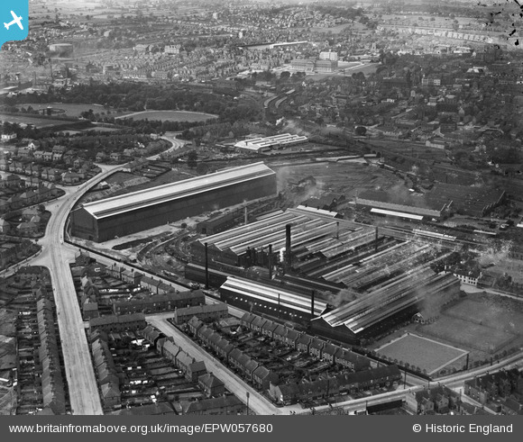
EPW057680 ENGLAND (1938). The Chesterfield Tube Company Ltd Works and environs, Chesterfield, 1938
© Copyright OpenStreetMap contributors and licensed by the OpenStreetMap Foundation. 2024. Cartography is licensed as CC BY-SA.
Nearby Images (7)
EPW057680

EPW057679

EPW057681

EPW057682

EPW057685

EPW057683

EPW057684

Details
| Title | [EPW057680] The Chesterfield Tube Company Ltd Works and environs, Chesterfield, 1938 |
| Reference | EPW057680 |
| Date | 20-June-1938 |
| Link | |
| Place name | CHESTERFIELD |
| Parish | |
| District | |
| Country | ENGLAND |
| Easting / Northing | 438283, 370426 |
| Longitude / Latitude | -1.4264519164427, 53.229211683442 |
| National Grid Reference | SK383704 |
Pins
 RichardL |
Wednesday 6th of August 2014 07:44:10 AM | |
RichardL |
Wednesday 6th of August 2014 07:37:30 AM | |
RichardL |
Wednesday 6th of August 2014 07:36:11 AM | |
RichardL |
Wednesday 6th of August 2014 07:33:35 AM | |
RichardL |
Wednesday 6th of August 2014 07:32:08 AM | |
RichardL |
Wednesday 6th of August 2014 07:28:56 AM | |
RichardL |
Wednesday 6th of August 2014 07:27:04 AM |