
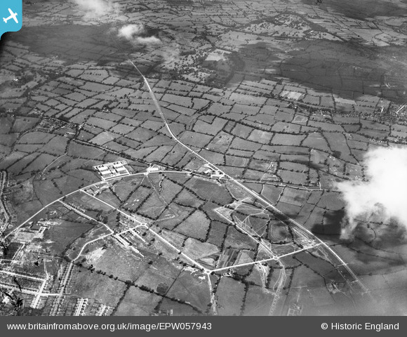
EPW057943 ENGLAND (1938). The Barnet By-Pass (A1) and eastern Borehamwood under construction, Borehamwood, from the south-west, 1938
© Copyright OpenStreetMap contributors and licensed by the OpenStreetMap Foundation. 2024. Cartography is licensed as CC BY-SA.
Nearby Images (7)
EPW057943
 and eastern Borehamwood under construction, Borehamwood, from the south-west, 1938")
EAW046961

EAW046960

EAW044298

EAW033382

EAW046964

EAW044303

Details
| Title | [EPW057943] The Barnet By-Pass (A1) and eastern Borehamwood under construction, Borehamwood, from the south-west, 1938 |
| Reference | EPW057943 |
| Date | 13-July-1938 |
| Link | |
| Place name | BOREHAMWOOD |
| Parish | ELSTREE AND BOREHAMWOOD |
| District | |
| Country | ENGLAND |
| Easting / Northing | 520574, 196247 |
| Longitude / Latitude | -0.25692386834694, 51.651601914819 |
| National Grid Reference | TQ206962 |
Pins
 ken |
Friday 14th of August 2015 08:27:39 PM |