
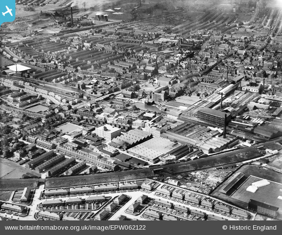
EPW062122 ENGLAND (1939). The Anchor Electric Cable Works and the town centre, Leigh, 1939
© Copyright OpenStreetMap contributors and licensed by the OpenStreetMap Foundation. 2024. Cartography is licensed as CC BY-SA.
Nearby Images (19)
EPW062122

EPW062120

EPW062118

EAW016782

EAW016777

EAW016781

EAW016786

EPW062121

EPW062125

EPW062119

EPW062123

EAW016776

EPW062124

EAW016783

EAW016785

EPW031125

EPW031119

EPW031118

EAW016780

Details
| Title | [EPW062122] The Anchor Electric Cable Works and the town centre, Leigh, 1939 |
| Reference | EPW062122 |
| Date | 30-June-1939 |
| Link | |
| Place name | LEIGH |
| Parish | |
| District | |
| Country | ENGLAND |
| Easting / Northing | 365668, 399772 |
| Longitude / Latitude | -2.5175443995828, 53.493281971668 |
| National Grid Reference | SJ657998 |
