
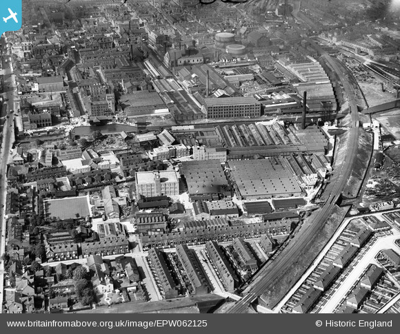
EPW062125 ENGLAND (1939). The Anchor Electric Cable Works and the Albion Engineering Works, Leigh, 1939
© Copyright OpenStreetMap contributors and licensed by the OpenStreetMap Foundation. 2024. Cartography is licensed as CC BY-SA.
Nearby Images (20)
EPW062125

EAW016781

EAW016777

EAW016776

EPW062123

EAW016786

EPW062119

EPW062121

EPW062124

EAW016785

EAW016783

EAW016782

EPW062122

EPW062120

EAW016780

EPW062118

EPW031125

EPW031119

EAW016778

EAW016779

Details
| Title | [EPW062125] The Anchor Electric Cable Works and the Albion Engineering Works, Leigh, 1939 |
| Reference | EPW062125 |
| Date | 30-June-1939 |
| Link | |
| Place name | LEIGH |
| Parish | |
| District | |
| Country | ENGLAND |
| Easting / Northing | 365722, 399657 |
| Longitude / Latitude | -2.5167178361646, 53.492251746055 |
| National Grid Reference | SJ657997 |
Pins
Be the first to add a comment to this image!