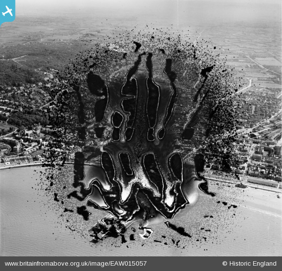
EAW015057 ENGLAND (1948). Marine Parade and the town, Weston-super-Mare, from the south-west, 1948. This image has been produced from a damaged negative.
© Hawlfraint cyfranwyr OpenStreetMap a thrwyddedwyd gan yr OpenStreetMap Foundation. 2025. Trwyddedir y gartograffeg fel CC BY-SA.
Delweddau cyfagos (19)
Manylion
| Pennawd | [EAW015057] Marine Parade and the town, Weston-super-Mare, from the south-west, 1948. This image has been produced from a damaged negative. |
| Cyfeirnod | EAW015057 |
| Dyddiad | 27-April-1948 |
| Dolen | |
| Enw lle | WESTON-SUPER-MARE |
| Plwyf | WESTON-SUPER-MARE |
| Ardal | |
| Gwlad | ENGLAND |
| Dwyreiniad / Gogleddiad | 331725, 161433 |
| Hydred / Lledred | -2.9804425575811, 51.347370614458 |
| Cyfeirnod Grid Cenedlaethol | ST317614 |
Pinnau
Byddwch y cyntaf i ychwanegu sylw at y ddelwedd hon!


![[EAW015057] Marine Parade and the town, Weston-super-Mare, from the south-west, 1948. This image has been produced from a damaged negative.](http://britainfromabove.org.uk/sites/all/libraries/aerofilms-images/public/100x100/EAW/015/EAW015057.jpg)
![[EPW023960] The Royal Parade, Weston-Super-Mare, 1928](http://britainfromabove.org.uk/sites/all/libraries/aerofilms-images/public/100x100/EPW/023/EPW023960.jpg)
![[EPW023970] The pier entrance, Weston-Super-Mare, 1928](http://britainfromabove.org.uk/sites/all/libraries/aerofilms-images/public/100x100/EPW/023/EPW023970.jpg)
![[EAW015056] Marine Parade and the town, Weston-super-Mare, 1948. This image has been produced from a damaged negative.](http://britainfromabove.org.uk/sites/all/libraries/aerofilms-images/public/100x100/EAW/015/EAW015056.jpg)
![[EPW048457] The Grand Pier and the town, Weston-Super-Mare, from the south, 1935](http://britainfromabove.org.uk/sites/all/libraries/aerofilms-images/public/100x100/EPW/048/EPW048457.jpg)
![[EAW025155] Crowds on the beach near the entrance to the Grand Pier, Weston-super-Mare, 1949](http://britainfromabove.org.uk/sites/all/libraries/aerofilms-images/public/100x100/EAW/025/EAW025155.jpg)
![[EPW001039] View over Weston-Super-Mare and the Grand Pier, Weston-Super-Mare, from the south-west, 1920](http://britainfromabove.org.uk/sites/all/libraries/aerofilms-images/public/100x100/EPW/001/EPW001039.jpg)
![[EPW039932] Marine Parade, Weston-super-Mare, 1932](http://britainfromabove.org.uk/sites/all/libraries/aerofilms-images/public/100x100/EPW/039/EPW039932.jpg)
![[EPW051716] Marine Parade by the Grand Pier and the town, Weston-super-Mare, from the south-west, 1936. This image has been produced from a copy-negative.](http://britainfromabove.org.uk/sites/all/libraries/aerofilms-images/public/100x100/EPW/051/EPW051716.jpg)
![[EPW048443] The Grand Pier, Weston Bay and the town, Weston-Super-Mare, from the south-east, 1935](http://britainfromabove.org.uk/sites/all/libraries/aerofilms-images/public/100x100/EPW/048/EPW048443.jpg)
![[EPW048456] The Grand Pier and the town, Weston-Super-Mare, from the south, 1935](http://britainfromabove.org.uk/sites/all/libraries/aerofilms-images/public/100x100/EPW/048/EPW048456.jpg)
![[EPW039934] The Grand Pier and the beach, Weston-super-Mare, from the south-east, 1932](http://britainfromabove.org.uk/sites/all/libraries/aerofilms-images/public/100x100/EPW/039/EPW039934.jpg)
![[EPW023969] The Royal Parade, Winter Gardens and Model Yacht Pond, Weston-Super-Mare, 1928](http://britainfromabove.org.uk/sites/all/libraries/aerofilms-images/public/100x100/EPW/023/EPW023969.jpg)
![[EAW016133] Grand Pier and the seafront, Weston-Super-Mare, from the south-east, 1948. This image has been produced from a damaged negative.](http://britainfromabove.org.uk/sites/all/libraries/aerofilms-images/public/100x100/EAW/016/EAW016133.jpg)
![[EPW051708] The Winter Gardens Pavilion, Weston-super-Mare, 1936. This image has been produced from a copy-negative.](http://britainfromabove.org.uk/sites/all/libraries/aerofilms-images/public/100x100/EPW/051/EPW051708.jpg)
![[EPW039936] Marine Parade, Beach Road and environs, Weston-super-Mare, 1932](http://britainfromabove.org.uk/sites/all/libraries/aerofilms-images/public/100x100/EPW/039/EPW039936.jpg)
![[EAW016134] Grand Pier and the seafront, Weston-Super-Mare, from the south, 1948. This image has been produced from a damaged negative.](http://britainfromabove.org.uk/sites/all/libraries/aerofilms-images/public/100x100/EAW/016/EAW016134.jpg)
![[EAW056067] Worlebury Hill and the sea front, Weston-super-Mare, from the south-east, 1954](http://britainfromabove.org.uk/sites/all/libraries/aerofilms-images/public/100x100/EAW/056/EAW056067.jpg)
![[EPW024072] The Model Yacht Pond, Weston-super-Mare, 1928](http://britainfromabove.org.uk/sites/all/libraries/aerofilms-images/public/100x100/EPW/024/EPW024072.jpg)