
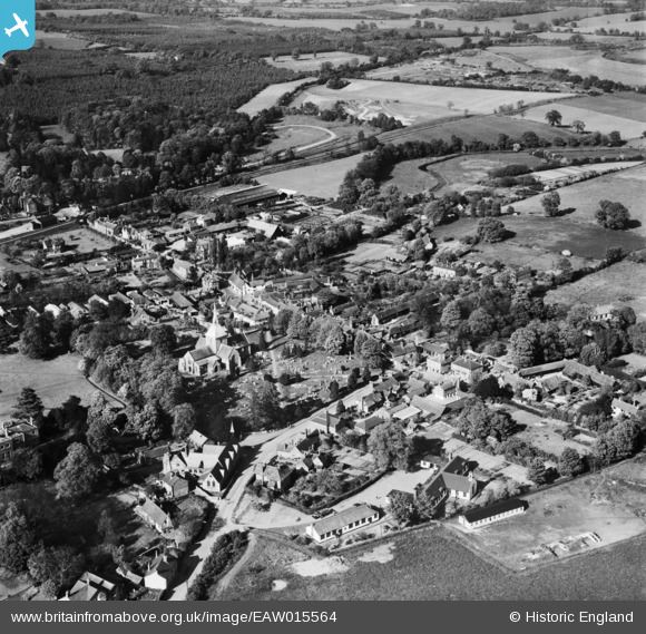
EAW015564 ENGLAND (1948). St Helen's Church and the village, Wheathampstead, 1948
© Hawlfraint cyfranwyr OpenStreetMap a thrwyddedwyd gan yr OpenStreetMap Foundation. 2025. Trwyddedir y gartograffeg fel CC BY-SA.
Delweddau cyfagos (10)
EAW015564

EAW015566

EAW015565

EAW015568

EAW015567

EAW047667

EAW000869

EAW000870

EAW047664

EAW047665

Manylion
| Pennawd | [EAW015564] St Helen's Church and the village, Wheathampstead, 1948 |
| Cyfeirnod | EAW015564 |
| Dyddiad | 13-May-1948 |
| Dolen | |
| Enw lle | WHEATHAMPSTEAD |
| Plwyf | WHEATHAMPSTEAD |
| Ardal | |
| Gwlad | ENGLAND |
| Dwyreiniad / Gogleddiad | 517775, 214053 |
| Hydred / Lledred | -0.29134213255807, 51.812238596861 |
| Cyfeirnod Grid Cenedlaethol | TL178141 |
Pinnau
 Duncan |
Monday 1st of December 2014 01:56:21 AM | |
Chells809 |
Thursday 26th of June 2014 10:21:42 PM | |
Local volunteers have restored the platform. |
John W |
Thursday 7th of July 2016 08:05:22 PM |