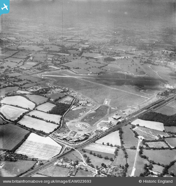
EAW023693 ENGLAND (1949). Gatwick Airport, Crawley, 1949
© Hawlfraint cyfranwyr OpenStreetMap a thrwyddedwyd gan yr OpenStreetMap Foundation. 2024. Trwyddedir y gartograffeg fel CC BY-SA.
Delweddau cyfagos (5)
Manylion
| Pennawd | [EAW023693] Gatwick Airport, Crawley, 1949 |
| Cyfeirnod | EAW023693 |
| Dyddiad | 12-June-1949 |
| Dolen | |
| Enw lle | CRAWLEY |
| Plwyf | |
| Ardal | |
| Gwlad | ENGLAND |
| Dwyreiniad / Gogleddiad | 528150, 140425 |
| Hydred / Lledred | -0.16762590746821, 51.148197154239 |
| Cyfeirnod Grid Cenedlaethol | TQ282404 |
Pinnau
 JUNGLEJIM |
Tuesday 22nd of December 2020 01:56:29 PM | |
 Biggles1951 |
Sunday 2nd of March 2014 03:26:07 PM | |
 Biggles1951 |
Sunday 2nd of March 2014 03:24:53 PM | |
 Biggles1951 |
Sunday 2nd of March 2014 03:22:19 PM | |
 Bunn72 |
Monday 13th of January 2014 02:11:00 PM | |
 Alan McFaden |
Thursday 19th of December 2013 09:47:29 PM | |
 cptpies |
Wednesday 18th of December 2013 08:16:39 AM | |
 cptpies |
Wednesday 18th of December 2013 08:16:06 AM |
Cyfraniadau Grŵp
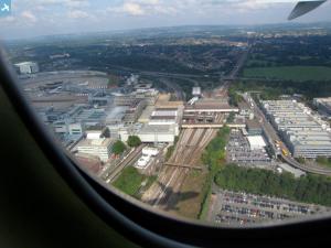
Gatwick Airport, 02/06/2014 |
 Class31 |
Wednesday 4th of June 2014 01:06:15 PM |


![[EAW023693] Gatwick Airport, Crawley, 1949](http://britainfromabove.org.uk/sites/all/libraries/aerofilms-images/public/100x100/EAW/023/EAW023693.jpg)
![[EAW048819] Gatwick Airport, Crawley, 1953. This image has been produced from a damaged negative.](http://britainfromabove.org.uk/sites/all/libraries/aerofilms-images/public/100x100/EAW/048/EAW048819.jpg)
![[EPW053262] Hunts Green and Gatwick Airport, Crawley, 1937. This image has been produced from a damaged negative.](http://britainfromabove.org.uk/sites/all/libraries/aerofilms-images/public/100x100/EPW/053/EPW053262.jpg)
![[EPW053264] Gatwick Airport, Crawley, 1937. This image has been produced from a damaged negative.](http://britainfromabove.org.uk/sites/all/libraries/aerofilms-images/public/100x100/EPW/053/EPW053264.jpg)
![[EAW023694] Gatwick Airport, Crawley, 1949](http://britainfromabove.org.uk/sites/all/libraries/aerofilms-images/public/100x100/EAW/023/EAW023694.jpg)
