
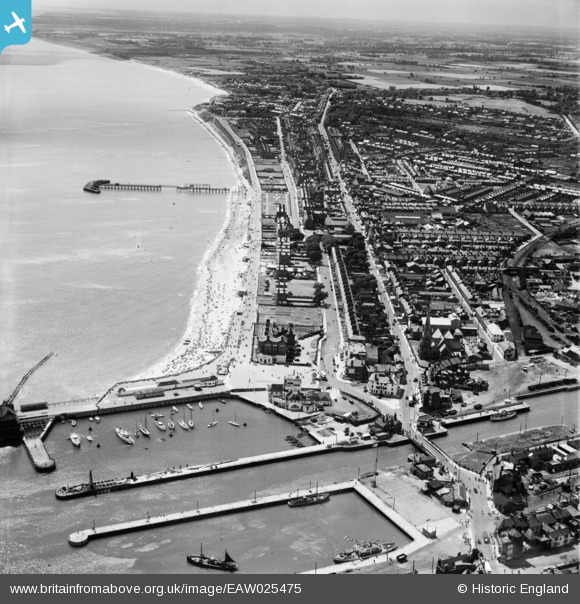
EAW025475 ENGLAND (1949). The South Basin and seafront, Lowestoft, from the north-east, 1949
© Hawlfraint cyfranwyr OpenStreetMap a thrwyddedwyd gan yr OpenStreetMap Foundation. 2025. Trwyddedir y gartograffeg fel CC BY-SA.
Delweddau cyfagos (16)
EAW025475

EAW031906

EAW047639

EPW021242

EAW052979

EAW052981

EAW031908

EPW021243

EAW031909

EAW047637

EAW052982

EAW005063

EAW047641

EAW052978

EAR032727

EAW031907

Manylion
| Pennawd | [EAW025475] The South Basin and seafront, Lowestoft, from the north-east, 1949 |
| Cyfeirnod | EAW025475 |
| Dyddiad | 28-July-1949 |
| Dolen | |
| Enw lle | LOWESTOFT |
| Plwyf | |
| Ardal | |
| Gwlad | ENGLAND |
| Dwyreiniad / Gogleddiad | 654786, 292618 |
| Hydred / Lledred | 1.7519376454172, 52.471547308207 |
| Cyfeirnod Grid Cenedlaethol | TM548926 |
Pinnau
 Matt Aldred edob.mattaldred.com |
Tuesday 1st of December 2020 08:00:06 PM | |
 Peter |
Thursday 30th of January 2014 12:27:21 PM | |
Peter |
Thursday 30th of January 2014 12:26:00 PM | |
Al |
Monday 13th of January 2014 12:12:15 AM | |
Brightonboy |
Saturday 21st of December 2013 11:00:43 PM | |
Brightonboy |
Saturday 21st of December 2013 10:59:27 PM | |
Brightonboy |
Saturday 21st of December 2013 10:58:49 PM | |
Brightonboy |
Saturday 21st of December 2013 10:58:05 PM |
Cyfraniadau Grŵp
 unrecorded t22 |
Al |
Monday 13th of January 2014 12:12:43 AM |