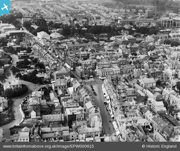
EPW000615 ENGLAND (1920). South Street, Worthing, 1920
© Hawlfraint cyfranwyr OpenStreetMap a thrwyddedwyd gan yr OpenStreetMap Foundation. 2025. Trwyddedir y gartograffeg fel CC BY-SA.
Delweddau cyfagos (6)
Manylion
| Pennawd | [EPW000615] South Street, Worthing, 1920 |
| Cyfeirnod | EPW000615 |
| Dyddiad | April-1920 |
| Dolen | |
| Enw lle | WORTHING |
| Plwyf | |
| Ardal | |
| Gwlad | ENGLAND |
| Dwyreiniad / Gogleddiad | 514935, 102621 |
| Hydred / Lledred | -0.36845240937805, 50.811160176165 |
| Cyfeirnod Grid Cenedlaethol | TQ149026 |
Pinnau
 Steph Baldwin |
Monday 17th of August 2020 04:36:07 PM | |
 Steph Baldwin |
Monday 17th of August 2020 04:32:09 PM | |
 Steph Baldwin |
Monday 17th of August 2020 04:31:52 PM | |
 Southdown |
Saturday 10th of May 2014 08:50:46 PM |


![[EPW000615] South Street, Worthing, 1920](http://britainfromabove.org.uk/sites/all/libraries/aerofilms-images/public/100x100/EPW/000/EPW000615.jpg)
![[EPW000764] The Town Hall, Worthing, 1920](http://britainfromabove.org.uk/sites/all/libraries/aerofilms-images/public/100x100/EPW/000/EPW000764.jpg)
![[EPW000719] South Street and the pier, Worthing, 1920. This image has been produced from a copy negative.](http://britainfromabove.org.uk/sites/all/libraries/aerofilms-images/public/100x100/EPW/000/EPW000719.jpg)
![[EPW016903] Steyne Gardens, Worthing, 1926](http://britainfromabove.org.uk/sites/all/libraries/aerofilms-images/public/100x100/EPW/016/EPW016903.jpg)
![[EPW054071] The Pier Pavilion and the town, Worthing, from the south-east, 1937](http://britainfromabove.org.uk/sites/all/libraries/aerofilms-images/public/100x100/EPW/054/EPW054071.jpg)
![[EPW042996] Marine Parade and environs, Worthing, 1933](http://britainfromabove.org.uk/sites/all/libraries/aerofilms-images/public/100x100/EPW/042/EPW042996.jpg)