
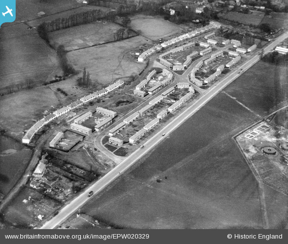
EPW020329 ENGLAND (1928). New housing at Stanhope Road, Greenford, 1928
© Hawlfraint cyfranwyr OpenStreetMap a thrwyddedwyd gan yr OpenStreetMap Foundation. 2025. Trwyddedir y gartograffeg fel CC BY-SA.
Delweddau cyfagos (10)
EPW020329

EPW020329
EPW020325

EPW020326

EPW020324

EPW020330

EPW020330
EPW020327

EPW056286

EPW056285

Manylion
| Pennawd | [EPW020329] New housing at Stanhope Road, Greenford, 1928 |
| Cyfeirnod | EPW020329 |
| Dyddiad | March-1928 |
| Dolen | |
| Enw lle | GREENFORD |
| Plwyf | |
| Ardal | |
| Gwlad | ENGLAND |
| Dwyreiniad / Gogleddiad | 514273, 181839 |
| Hydred / Lledred | -0.35266404904447, 51.523409941503 |
| Cyfeirnod Grid Cenedlaethol | TQ143818 |
Pinnau
 Aaron Wiles |
Thursday 20th of June 2013 01:45:33 PM | |
Aaron Wiles |
Thursday 20th of June 2013 01:44:30 PM | |
Aaron Wiles |
Thursday 20th of June 2013 01:43:26 PM | |
Aaron Wiles |
Thursday 20th of June 2013 01:42:51 PM | |
/ Bus Depot |
Aaron Wiles |
Thursday 20th of June 2013 01:47:12 PM |
Aaron Wiles |
Thursday 20th of June 2013 01:42:13 PM | |
Aaron Wiles |
Thursday 20th of June 2013 01:42:00 PM | |
Bingly Road? |
kim |
Monday 21st of October 2013 10:21:34 PM |
Aaron Wiles |
Thursday 20th of June 2013 01:41:33 PM | |
Aaron Wiles |
Thursday 20th of June 2013 01:40:00 PM | |
Aaron Wiles |
Thursday 20th of June 2013 01:39:26 PM |