
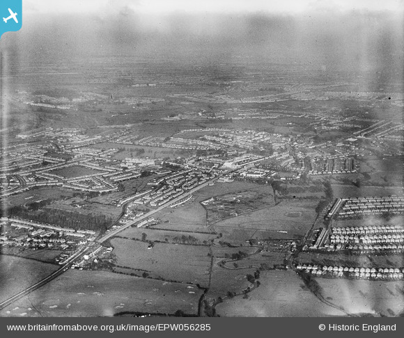
EPW056285 ENGLAND (1938). Greenford and the Ealing Coropoation Sewage Works, Greenford, from the south-east, 1938
© Hawlfraint cyfranwyr OpenStreetMap a thrwyddedwyd gan yr OpenStreetMap Foundation. 2025. Trwyddedir y gartograffeg fel CC BY-SA.
Delweddau cyfagos (3)
EPW056285

EPW020329

EPW020329
Manylion
| Pennawd | [EPW056285] Greenford and the Ealing Coropoation Sewage Works, Greenford, from the south-east, 1938 |
| Cyfeirnod | EPW056285 |
| Dyddiad | 17-January-1938 |
| Dolen | |
| Enw lle | GREENFORD |
| Plwyf | |
| Ardal | |
| Gwlad | ENGLAND |
| Dwyreiniad / Gogleddiad | 514481, 181605 |
| Hydred / Lledred | -0.34974294916112, 51.521264443546 |
| Cyfeirnod Grid Cenedlaethol | TQ145816 |
Pinnau
 Des Elmes |
Thursday 14th of April 2016 05:07:01 PM | |
Des Elmes |
Thursday 14th of April 2016 05:05:13 PM | |
Des Elmes |
Thursday 14th of April 2016 05:04:05 PM | |
Des Elmes |
Thursday 14th of April 2016 05:03:11 PM | |
 Jintygirl |
Wednesday 5th of March 2014 01:30:12 PM | |
Jintygirl |
Wednesday 5th of March 2014 01:27:07 PM | |
Jintygirl |
Wednesday 5th of March 2014 01:14:55 PM | |
Jintygirl |
Wednesday 5th of March 2014 01:14:07 PM | |
Jintygirl |
Wednesday 5th of March 2014 01:10:08 PM |