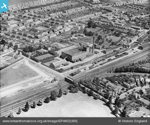
EPW021891 ENGLAND (1928). Horlicks Malted Milk Factory, Slough, 1928
© Hawlfraint cyfranwyr OpenStreetMap a thrwyddedwyd gan yr OpenStreetMap Foundation. 2025. Trwyddedir y gartograffeg fel CC BY-SA.
Delweddau cyfagos (27)
Manylion
| Pennawd | [EPW021891] Horlicks Malted Milk Factory, Slough, 1928 |
| Cyfeirnod | EPW021891 |
| Dyddiad | July-1928 |
| Dolen | |
| Enw lle | SLOUGH |
| Plwyf | |
| Ardal | |
| Gwlad | ENGLAND |
| Dwyreiniad / Gogleddiad | 497261, 180403 |
| Hydred / Lledred | -0.59821605776224, 51.513687433839 |
| Cyfeirnod Grid Cenedlaethol | SU973804 |
Pinnau
 Class31 |
Wednesday 3rd of July 2013 09:11:10 PM | |
 Class31 |
Wednesday 3rd of July 2013 08:53:59 PM | |
 Class31 |
Wednesday 3rd of July 2013 08:23:20 PM | |
 Class31 |
Wednesday 3rd of July 2013 07:42:57 PM | |
 Class31 |
Wednesday 3rd of July 2013 07:33:35 PM | |
 Class31 |
Wednesday 3rd of July 2013 07:11:47 PM | |
 Class31 |
Wednesday 3rd of July 2013 05:50:39 PM | |
 Mike Holder |
Sunday 4th of November 2012 05:39:22 PM | |
 dave43 |
Wednesday 25th of July 2012 10:15:06 PM | |
I think you are correct; I used to walk past them myself on the way home from school. There was a pub around the corner, at the junction with Stoke road, called the Bricklayers Arms(?). |
 Mike Holder |
Sunday 4th of November 2012 05:43:36 PM |
 dave43 |
Wednesday 25th of July 2012 10:14:59 PM | |
 dave43 |
Wednesday 25th of July 2012 10:14:41 PM | |
 Mr Jauncey |
Thursday 28th of June 2012 12:34:04 PM |
Cyfraniadau Grŵp
Horlicks Factory from The Red Dragon 08/04/2014 |
 Class31 |
Thursday 10th of April 2014 07:34:46 PM |
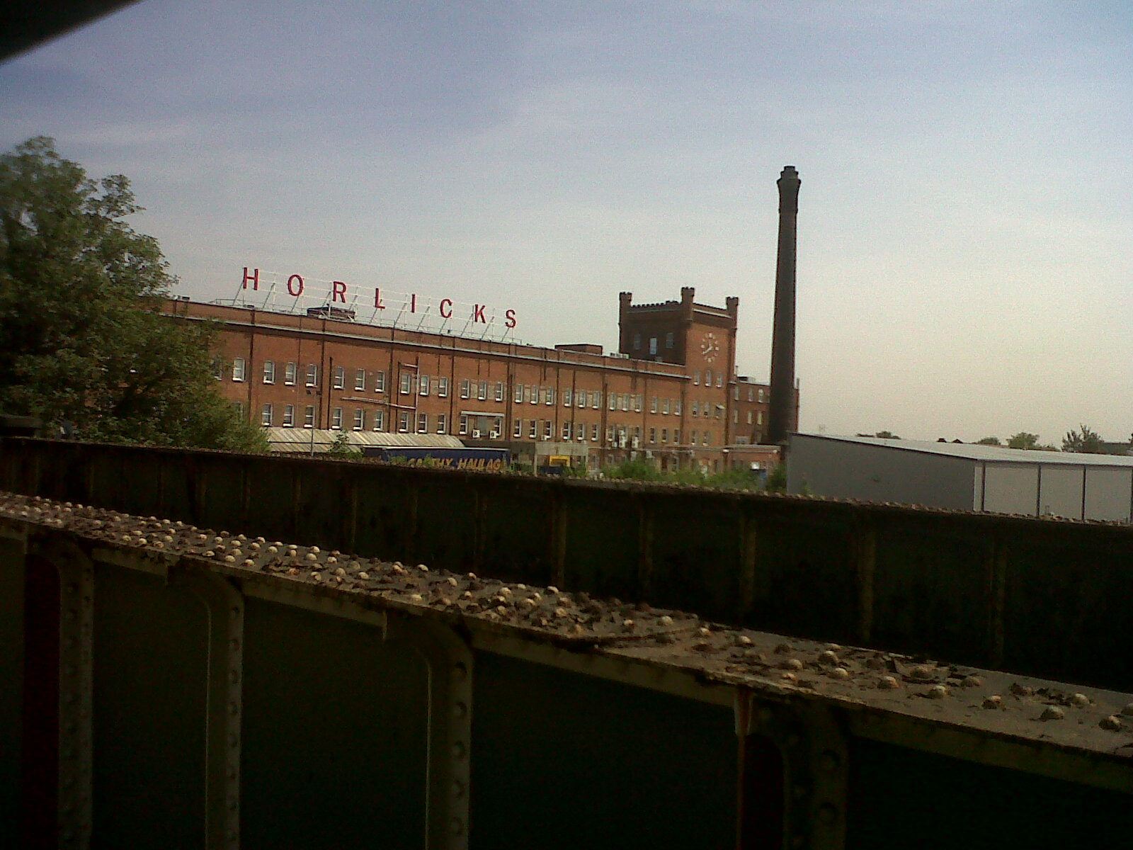
 Horlicks Factory from the Stoke Poges Lane railway bridge . Photograph taken today. |
 Class31 |
Tuesday 16th of July 2013 10:17:19 PM |
 Lansdowne Avenue at the junction with Stoke Poges Lane looking east.Photograph taken today. |
 Class31 |
Tuesday 16th of July 2013 10:15:34 PM |
 Salt Hill Park. Photograph taken today looking west. |
 Class31 |
Tuesday 16th of July 2013 10:13:46 PM |
View looking north east. |
 Class31 |
Wednesday 3rd of July 2013 08:42:42 PM |


![[EPW021891] Horlicks Malted Milk Factory, Slough, 1928](http://britainfromabove.org.uk/sites/all/libraries/aerofilms-images/public/100x100/EPW/021/EPW021891.jpg)
![[EPW031196] The Horlicks Malted Milk Factory and environs, Slough, 1929](http://britainfromabove.org.uk/sites/all/libraries/aerofilms-images/public/100x100/EPW/031/EPW031196.jpg)
![[EPW008010] The Horlicks Malted Milk Co Factory, Slough, 1922. This image has been produced from a copy-negative.](http://britainfromabove.org.uk/sites/all/libraries/aerofilms-images/public/100x100/EPW/008/EPW008010.jpg)
![[EPW031194] The Horlicks Malted Milk Factory and environs, Slough, 1929](http://britainfromabove.org.uk/sites/all/libraries/aerofilms-images/public/100x100/EPW/031/EPW031194.jpg)
![[EPW021787] Horlicks Malted Milk Factory, Slough, 1928](http://britainfromabove.org.uk/sites/all/libraries/aerofilms-images/public/100x100/EPW/021/EPW021787.jpg)
![[EPW031198] The Horlicks Malted Milk Factory and environs, Slough, 1929](http://britainfromabove.org.uk/sites/all/libraries/aerofilms-images/public/100x100/EPW/031/EPW031198.jpg)
![[EPW021892] Horlicks Malted Milk Factory, Slough, 1928](http://britainfromabove.org.uk/sites/all/libraries/aerofilms-images/public/100x100/EPW/021/EPW021892.jpg)
![[EPW021789] Horlicks Malted Milk Factory, Slough, 1928](http://britainfromabove.org.uk/sites/all/libraries/aerofilms-images/public/100x100/EPW/021/EPW021789.jpg)
![[EPW031193] The Horlicks Malted Milk Factory, Slough, 1929](http://britainfromabove.org.uk/sites/all/libraries/aerofilms-images/public/100x100/EPW/031/EPW031193.jpg)
![[EPW021893] Horlicks Malted Milk Factory, Slough, 1928](http://britainfromabove.org.uk/sites/all/libraries/aerofilms-images/public/100x100/EPW/021/EPW021893.jpg)
![[EPW031197] The Horlicks Malted Milk Factory and environs, Slough, 1929](http://britainfromabove.org.uk/sites/all/libraries/aerofilms-images/public/100x100/EPW/031/EPW031197.jpg)
![[EPW021790] Horlicks Malted Milk Factory and surroundings, Slough, 1928](http://britainfromabove.org.uk/sites/all/libraries/aerofilms-images/public/100x100/EPW/021/EPW021790.jpg)
![[EPW021896] Horlicks Malted Milk Factory, Slough, 1928](http://britainfromabove.org.uk/sites/all/libraries/aerofilms-images/public/100x100/EPW/021/EPW021896.jpg)
![[EPW031195] The Horlicks Malted Milk Factory and environs, Slough, 1929](http://britainfromabove.org.uk/sites/all/libraries/aerofilms-images/public/100x100/EPW/031/EPW031195.jpg)
![[EPW031607] Horlick's Malted Milk Co Ltd Malted Milk Factory, Slough, 1930](http://britainfromabove.org.uk/sites/all/libraries/aerofilms-images/public/100x100/EPW/031/EPW031607.jpg)
![[EPW031606] Horlick's Malted Milk Co Ltd Malted Milk Factory, Slough, 1930](http://britainfromabove.org.uk/sites/all/libraries/aerofilms-images/public/100x100/EPW/031/EPW031606.jpg)
![[EPW021894] Horlicks Malted Milk Factory, Slough, 1928](http://britainfromabove.org.uk/sites/all/libraries/aerofilms-images/public/100x100/EPW/021/EPW021894.jpg)
![[EPW021889] Horlicks Malted Milk Factory, Slough, 1928](http://britainfromabove.org.uk/sites/all/libraries/aerofilms-images/public/100x100/EPW/021/EPW021889.jpg)
![[EPW031608] Horlick's Malted Milk Co Ltd Malted Milk Factory, Slough, 1930](http://britainfromabove.org.uk/sites/all/libraries/aerofilms-images/public/100x100/EPW/031/EPW031608.jpg)
![[EPW021788] Horlicks Malted Milk Factory, Slough, 1928](http://britainfromabove.org.uk/sites/all/libraries/aerofilms-images/public/100x100/EPW/021/EPW021788.jpg)
![[EPW021785] Horlicks Malted Milk Factory, Slough, 1928](http://britainfromabove.org.uk/sites/all/libraries/aerofilms-images/public/100x100/EPW/021/EPW021785.jpg)
![[EPW031603] Horlick's Malted Milk Co Ltd Malted Milk Factory, Slough, 1930](http://britainfromabove.org.uk/sites/all/libraries/aerofilms-images/public/100x100/EPW/031/EPW031603.jpg)
![[EPW021895] Horlicks Malted Milk Factory, Slough, 1928](http://britainfromabove.org.uk/sites/all/libraries/aerofilms-images/public/100x100/EPW/021/EPW021895.jpg)
![[EPW021890] Horlicks Malted Milk Factory, Slough, 1928](http://britainfromabove.org.uk/sites/all/libraries/aerofilms-images/public/100x100/EPW/021/EPW021890.jpg)
![[EPW021888] Horlicks Malted Milk Factory, Slough, 1928](http://britainfromabove.org.uk/sites/all/libraries/aerofilms-images/public/100x100/EPW/021/EPW021888.jpg)
![[EPW021786] Horlicks Malted Milk Factory, Slough, 1928](http://britainfromabove.org.uk/sites/all/libraries/aerofilms-images/public/100x100/EPW/021/EPW021786.jpg)
![[EPW051468] The Horlicks Factory and surrounding housing development, Slough, 1936](http://britainfromabove.org.uk/sites/all/libraries/aerofilms-images/public/100x100/EPW/051/EPW051468.jpg)