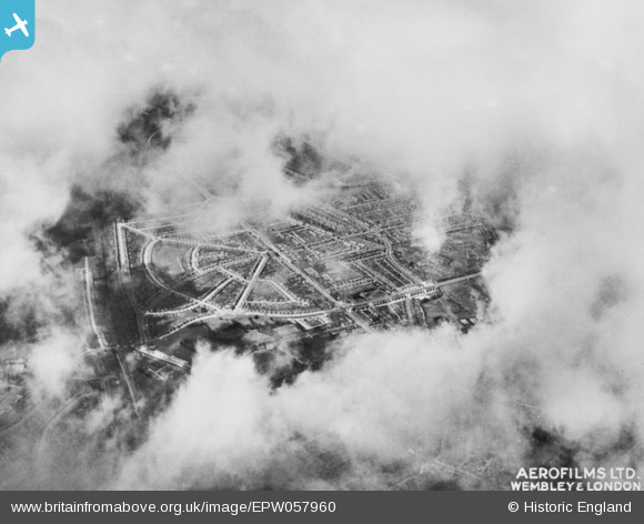
EPW057960 ENGLAND (1938). The area around Eastcote Lane, South Harrow, 1938. This image has been produced from a copy-negative.
© Hawlfraint cyfranwyr OpenStreetMap a thrwyddedwyd gan yr OpenStreetMap Foundation. 2024. Trwyddedir y gartograffeg fel CC BY-SA.
Delweddau cyfagos (7)
Manylion
| Pennawd | [EPW057960] The area around Eastcote Lane, South Harrow, 1938. This image has been produced from a copy-negative. |
| Cyfeirnod | EPW057960 |
| Dyddiad | 13-July-1938 |
| Dolen | |
| Enw lle | SOUTH HARROW |
| Plwyf | |
| Ardal | |
| Gwlad | ENGLAND |
| Dwyreiniad / Gogleddiad | 512825, 186208 |
| Hydred / Lledred | -0.37212795755899, 51.562973245015 |
| Cyfeirnod Grid Cenedlaethol | TQ128862 |
Pinnau
 alec |
Monday 24th of August 2020 02:15:27 AM | |
 Peter |
Monday 4th of November 2019 01:57:08 PM | |
 MATT SPRING |
Wednesday 5th of August 2015 04:52:42 PM |


![[EPW057960] The area around Eastcote Lane, South Harrow, 1938. This image has been produced from a copy-negative.](http://britainfromabove.org.uk/sites/all/libraries/aerofilms-images/public/100x100/EPW/057/EPW057960.jpg)
![[EPW025890] New housing off Eastcote Lane, South Harrow, 1929](http://britainfromabove.org.uk/sites/all/libraries/aerofilms-images/public/100x100/EPW/025/EPW025890.jpg)
![[EPW025891] New housing off Eastcote Lane, South Harrow, 1929](http://britainfromabove.org.uk/sites/all/libraries/aerofilms-images/public/100x100/EPW/025/EPW025891.jpg)
![[EPW025888] New housing off Eastcote Lane, South Harrow, 1929](http://britainfromabove.org.uk/sites/all/libraries/aerofilms-images/public/100x100/EPW/025/EPW025888.jpg)
![[EPW025889] New housing off Eastcote Lane, South Harrow, 1929](http://britainfromabove.org.uk/sites/all/libraries/aerofilms-images/public/100x100/EPW/025/EPW025889.jpg)
![[EPW040812] Eastcote Lane, Stuart Avenue and environs, South Harrow, from the south-west, 1933](http://britainfromabove.org.uk/sites/all/libraries/aerofilms-images/public/100x100/EPW/040/EPW040812.jpg)
![[EPW040815] Eastcote Lane, Rosebery Avenue and environs, South Harrow, from the south-west, 1933](http://britainfromabove.org.uk/sites/all/libraries/aerofilms-images/public/100x100/EPW/040/EPW040815.jpg)