
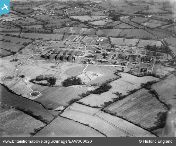
EAW000020 ENGLAND (1946). RAF Wythall (Barrage Balloon Station), Wythall, 1946
© Copyright OpenStreetMap contributors and licensed by the OpenStreetMap Foundation. 2025. Cartography is licensed as CC BY-SA.
Nearby Images (7)
EAW000020
, Wythall, 1946")
EAW000016
, Wythall, 1946")
EAW000018
, Wythall, 1946")
EAW000019
, Wythall, 1946")
EAW000017
, Wythall, 1946")
EAW000021
, Wythall, 1946")
EAW000022
 and surrounding countryside, Wythall, 1946")
Details
| Title | [EAW000020] RAF Wythall (Barrage Balloon Station), Wythall, 1946 |
| Reference | EAW000020 |
| Date | 24-January-1946 |
| Link | |
| Place name | WYTHALL |
| Parish | WYTHALL |
| District | |
| Country | ENGLAND |
| Easting / Northing | 406984, 275137 |
| Longitude / Latitude | -1.8974007044773, 52.373849549063 |
| National Grid Reference | SP070751 |
Pins
Be the first to add a comment to this image!