
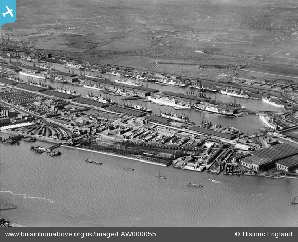
EAW000055 ENGLAND (1946). The King George V Dock and the Royal Albert Dock, Beckton, 1946
© Copyright OpenStreetMap contributors and licensed by the OpenStreetMap Foundation. 2025. Cartography is licensed as CC BY-SA.
Nearby Images (16)
EAW000055

EAW000050

EAW000051

EAW049351

EAW000054

EAW000058

EAW000057

EAW005289

EAW008726

EAW022360

EAW008740

EAW008722

EPW021370

EPW008885

EAW014133

EAW008724

Details
| Title | [EAW000055] The King George V Dock and the Royal Albert Dock, Beckton, 1946 |
| Reference | EAW000055 |
| Date | 31-March-1946 |
| Link | |
| Place name | BECKTON |
| Parish | |
| District | |
| Country | ENGLAND |
| Easting / Northing | 543345, 180184 |
| Longitude / Latitude | 0.065495517544629, 51.501906073732 |
| National Grid Reference | TQ433802 |
Pins
 Kentishman |
Wednesday 18th of May 2022 10:17:32 AM | |
Kentishman |
Wednesday 18th of May 2022 10:04:11 AM | |
pf329 |
Saturday 15th of May 2021 06:16:30 PM | |
redmist |
Tuesday 30th of June 2020 08:15:54 PM | |
redmist |
Tuesday 30th of June 2020 07:49:59 PM | |
redmist |
Monday 29th of June 2020 07:02:44 PM | |
redmist |
Sunday 28th of June 2020 09:59:16 AM | |
redmist |
Saturday 27th of June 2020 09:50:30 PM |