
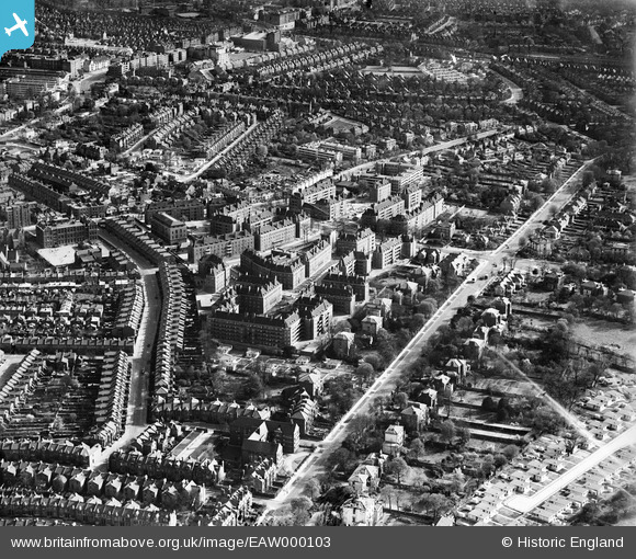
EAW000103 ENGLAND (1946). Kings Avenue, blocks of flats off Atkins Road and environs, Clapham Park, 1946
© Copyright OpenStreetMap contributors and licensed by the OpenStreetMap Foundation. 2025. Cartography is licensed as CC BY-SA.
Nearby Images (8)
EAW000103

EAW000102

EAW000101

EAW000100

EAW030128

EAW000104

EAW000099

EAW000105

Details
| Title | [EAW000103] Kings Avenue, blocks of flats off Atkins Road and environs, Clapham Park, 1946 |
| Reference | EAW000103 |
| Date | 4-April-1946 |
| Link | |
| Place name | CLAPHAM PARK |
| Parish | |
| District | |
| Country | ENGLAND |
| Easting / Northing | 530029, 173813 |
| Longitude / Latitude | -0.12860764633267, 51.447866232277 |
| National Grid Reference | TQ300738 |
Pins
 Post-war prefabs |
Tuesday 26th of March 2024 02:12:45 PM | |
Rob |
Wednesday 3rd of June 2015 09:08:14 PM | |
Rob |
Wednesday 3rd of June 2015 08:57:56 PM | |
Rob |
Wednesday 3rd of June 2015 08:56:49 PM | |
brianbeckett |
Thursday 18th of September 2014 11:10:10 AM |