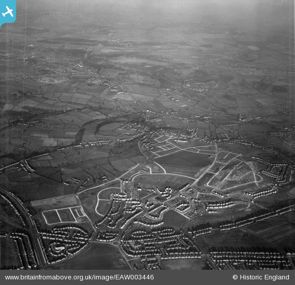
EAW003446 ENGLAND (1946). Housing estate under construction to the north of Deerlands Avenue, Parson Cross, from the south, 1946
© Copyright OpenStreetMap contributors and licensed by the OpenStreetMap Foundation. 2024. Cartography is licensed as CC BY-SA.
Details
| Title | [EAW003446] Housing estate under construction to the north of Deerlands Avenue, Parson Cross, from the south, 1946 |
| Reference | EAW003446 |
| Date | 4-December-1946 |
| Link | |
| Place name | PARSON CROSS |
| Parish | |
| District | |
| Country | ENGLAND |
| Easting / Northing | 434900, 393220 |
| Longitude / Latitude | -1.4746212458438, 53.434347764671 |
| National Grid Reference | SK349932 |
Pins
 martinmj |
Wednesday 13th of July 2022 10:22:28 PM | |
 martinmj |
Wednesday 13th of July 2022 10:21:34 PM | |
 redmist |
Thursday 17th of January 2019 11:06:56 PM | |
 redmist |
Thursday 17th of January 2019 11:06:18 PM |


![[EAW003446] Housing estate under construction to the north of Deerlands Avenue, Parson Cross, from the south, 1946](http://britainfromabove.org.uk/sites/all/libraries/aerofilms-images/public/100x100/EAW/003/EAW003446.jpg)
![[EAW003447] Housing estate under construction to the north of Deerlands Avenue, Parson Cross, from the south-east, 1946](http://britainfromabove.org.uk/sites/all/libraries/aerofilms-images/public/100x100/EAW/003/EAW003447.jpg)
![[EAW003443] Housing estate under construction to the north of Deerlands Avenue, Parson Cross, from the south, 1946](http://britainfromabove.org.uk/sites/all/libraries/aerofilms-images/public/100x100/EAW/003/EAW003443.jpg)
![[EAW003448] Housing estate under construction to the north of Deerlands Avenue, Parson Cross, 1946](http://britainfromabove.org.uk/sites/all/libraries/aerofilms-images/public/100x100/EAW/003/EAW003448.jpg)