
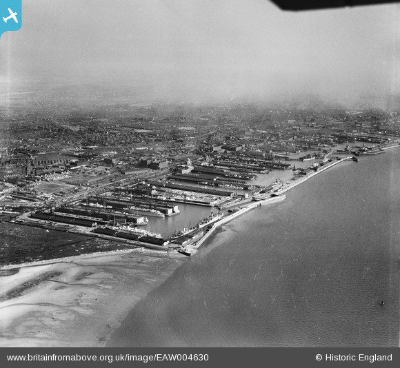
EAW004630 ENGLAND (1947). Gladstone Dock to Canada Dock, Bootle, from the north-west, 1947
© Copyright OpenStreetMap contributors and licensed by the OpenStreetMap Foundation. 2025. Cartography is licensed as CC BY-SA.
Nearby Images (18)
EAW004630

EAW004632

EPW037727

EAW004633

EAW001711

EAW048047

EPW018872

EAW048044

EPW023555

EAW051426

EPW018921

EAW048043

EPW018898

EPW023554

EPW018873

EAW042532

EPW018923

EPW018920

Details
| Title | [EAW004630] Gladstone Dock to Canada Dock, Bootle, from the north-west, 1947 |
| Reference | EAW004630 |
| Date | 17-April-1947 |
| Link | |
| Place name | BOOTLE |
| Parish | |
| District | |
| Country | ENGLAND |
| Easting / Northing | 332342, 395794 |
| Longitude / Latitude | -3.019000896241, 53.454296855773 |
| National Grid Reference | SJ323958 |
Pins
 rivermersey |
Thursday 22nd of July 2021 02:24:50 PM | |
redmist |
Friday 12th of February 2021 12:01:48 PM | |
redmist |
Friday 12th of February 2021 12:01:23 PM | |
redmist |
Friday 12th of February 2021 12:01:00 PM | |
redmist |
Friday 12th of February 2021 12:00:06 PM |