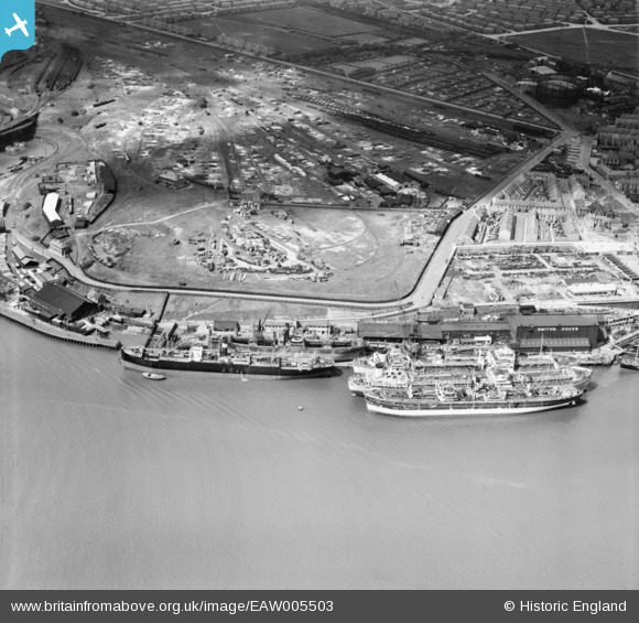
EAW005503 ENGLAND (1947). Smith's Docks and the adjacent Timber Yard, North Shields, 1947
© Copyright OpenStreetMap contributors and licensed by the OpenStreetMap Foundation. 2025. Cartography is licensed as CC BY-SA.
Nearby Images (7)
Details
| Title | [EAW005503] Smith's Docks and the adjacent Timber Yard, North Shields, 1947 |
| Reference | EAW005503 |
| Date | 15-May-1947 |
| Link | |
| Place name | NORTH SHIELDS |
| Parish | |
| District | |
| Country | ENGLAND |
| Easting / Northing | 435451, 567277 |
| Longitude / Latitude | -1.4457665646955, 54.998732195225 |
| National Grid Reference | NZ355673 |
Pins
 MB |
Monday 4th of November 2013 11:48:53 PM | |
 MB |
Monday 4th of November 2013 11:47:54 PM | |
 MB |
Monday 4th of November 2013 11:46:42 PM | |
 MB |
Monday 4th of November 2013 11:42:59 PM |


![[EAW005503] Smith's Docks and the adjacent Timber Yard, North Shields, 1947](http://britainfromabove.org.uk/sites/all/libraries/aerofilms-images/public/100x100/EAW/005/EAW005503.jpg)
![[EAW005504] Smith's Docks and the adjacent Timber Yard, North Shields, 1947](http://britainfromabove.org.uk/sites/all/libraries/aerofilms-images/public/100x100/EAW/005/EAW005504.jpg)
![[EAW005502] Smith's Docks, the Bull Ring Graving Docks and the Albert Edward Dock, North Shields, 1947](http://britainfromabove.org.uk/sites/all/libraries/aerofilms-images/public/100x100/EAW/005/EAW005502.jpg)
![[EAW005498] Smith's Docks and the Bull Ring Graving Docks alongside Shields Harbour, North Shields, 1947](http://britainfromabove.org.uk/sites/all/libraries/aerofilms-images/public/100x100/EAW/005/EAW005498.jpg)
![[EAW005501] Smith's Docks, the Bull Ring Graving Docks and the adjacent Timber Yard, North Shields, 1947](http://britainfromabove.org.uk/sites/all/libraries/aerofilms-images/public/100x100/EAW/005/EAW005501.jpg)
![[EPW025058] The Albert Edward Dock and the Timber Yards, Royal Quays, from the north-east, 1928](http://britainfromabove.org.uk/sites/all/libraries/aerofilms-images/public/100x100/EPW/025/EPW025058.jpg)
![[EAW005499] Smith's Docks, the Bull Ring Graving Docks and the town, North Shields, 1947](http://britainfromabove.org.uk/sites/all/libraries/aerofilms-images/public/100x100/EAW/005/EAW005499.jpg)