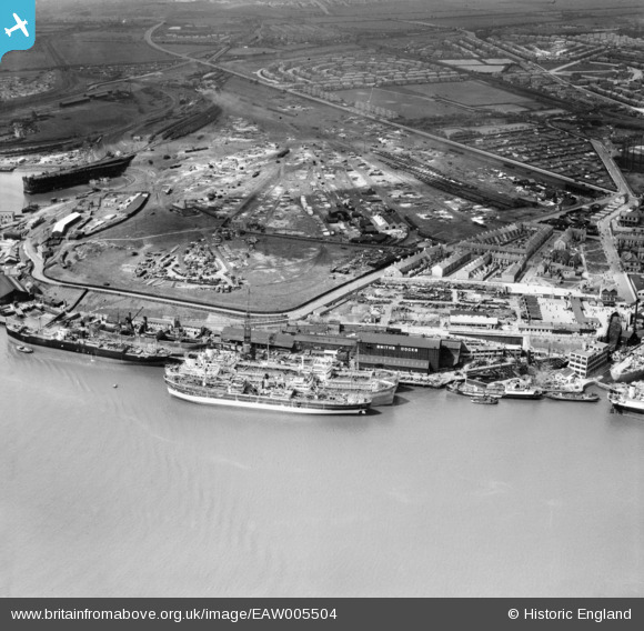
EAW005504 ENGLAND (1947). Smith's Docks and the adjacent Timber Yard, North Shields, 1947
© Copyright OpenStreetMap contributors and licensed by the OpenStreetMap Foundation. 2025. Cartography is licensed as CC BY-SA.
Nearby Images (8)
Details
| Title | [EAW005504] Smith's Docks and the adjacent Timber Yard, North Shields, 1947 |
| Reference | EAW005504 |
| Date | 15-May-1947 |
| Link | |
| Place name | NORTH SHIELDS |
| Parish | |
| District | |
| Country | ENGLAND |
| Easting / Northing | 435448, 567353 |
| Longitude / Latitude | -1.4458040497267, 54.999415405638 |
| National Grid Reference | NZ354674 |
Pins
 redmist |
Thursday 23rd of November 2023 04:22:14 PM |


![[EAW005504] Smith's Docks and the adjacent Timber Yard, North Shields, 1947](http://britainfromabove.org.uk/sites/all/libraries/aerofilms-images/public/100x100/EAW/005/EAW005504.jpg)
![[EAW005502] Smith's Docks, the Bull Ring Graving Docks and the Albert Edward Dock, North Shields, 1947](http://britainfromabove.org.uk/sites/all/libraries/aerofilms-images/public/100x100/EAW/005/EAW005502.jpg)
![[EAW005498] Smith's Docks and the Bull Ring Graving Docks alongside Shields Harbour, North Shields, 1947](http://britainfromabove.org.uk/sites/all/libraries/aerofilms-images/public/100x100/EAW/005/EAW005498.jpg)
![[EAW005503] Smith's Docks and the adjacent Timber Yard, North Shields, 1947](http://britainfromabove.org.uk/sites/all/libraries/aerofilms-images/public/100x100/EAW/005/EAW005503.jpg)
![[EAW005501] Smith's Docks, the Bull Ring Graving Docks and the adjacent Timber Yard, North Shields, 1947](http://britainfromabove.org.uk/sites/all/libraries/aerofilms-images/public/100x100/EAW/005/EAW005501.jpg)
![[EAW005500] Smith's Docks, the Bull Ring Graving Docks and the town, North Shields, 1947](http://britainfromabove.org.uk/sites/all/libraries/aerofilms-images/public/100x100/EAW/005/EAW005500.jpg)
![[EAW005499] Smith's Docks, the Bull Ring Graving Docks and the town, North Shields, 1947](http://britainfromabove.org.uk/sites/all/libraries/aerofilms-images/public/100x100/EAW/005/EAW005499.jpg)
![[EPW025058] The Albert Edward Dock and the Timber Yards, Royal Quays, from the north-east, 1928](http://britainfromabove.org.uk/sites/all/libraries/aerofilms-images/public/100x100/EPW/025/EPW025058.jpg)