
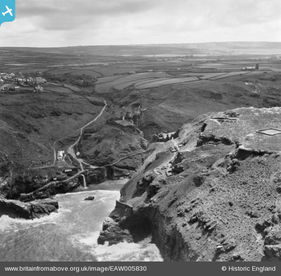
EAW005830 ENGLAND (1947). Archaeological remains on The Island and mainland, Tintagel, from the north, 1947. This image has been produced from a print.
© Copyright OpenStreetMap contributors and licensed by the OpenStreetMap Foundation. 2025. Cartography is licensed as CC BY-SA.
Nearby Images (16)
EAW005830

EAW031043

EAW031041

EAW020264

EAW031046

EAW031042

EAW031045

EAW005828

EAW005832

EAW005831

EAW005829

EAW031015

EAW031044

EAW031019

EAW031040

EAW005833

Details
| Title | [EAW005830] Archaeological remains on The Island and mainland, Tintagel, from the north, 1947. This image has been produced from a print. |
| Reference | EAW005830 |
| Date | 18-May-1947 |
| Link | |
| Place name | TINTAGEL |
| Parish | TINTAGEL |
| District | |
| Country | ENGLAND |
| Easting / Northing | 205066, 89152 |
| Longitude / Latitude | -4.7589204951941, 50.668772486451 |
| National Grid Reference | SX051892 |
Pins
Be the first to add a comment to this image!