
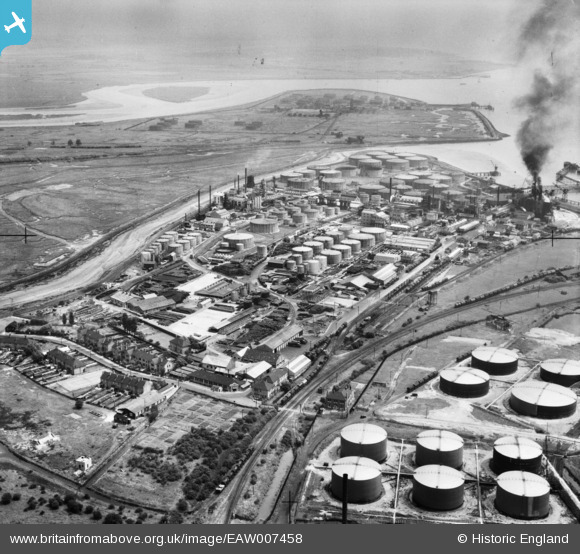
EAW007458 ENGLAND (1947). Part of the Coryton Oil Refinery complex, Coryton, 1947
© Copyright OpenStreetMap contributors and licensed by the OpenStreetMap Foundation. 2025. Cartography is licensed as CC BY-SA.
Nearby Images (8)
EAW007458

EAW007455

EAW007454

EAW003536

EAW007459

EAW007463

EAW021801

EAW007450

Details
| Title | [EAW007458] Part of the Coryton Oil Refinery complex, Coryton, 1947 |
| Reference | EAW007458 |
| Date | 25-June-1947 |
| Link | |
| Place name | CORYTON |
| Parish | |
| District | |
| Country | ENGLAND |
| Easting / Northing | 574055, 181906 |
| Longitude / Latitude | 0.50843799414216, 51.508753791484 |
| National Grid Reference | TQ741819 |
