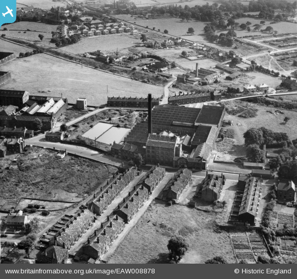
EAW008878 ENGLAND (1947). The Leafield Woollen Mills, Yeadon, 1947
© Copyright OpenStreetMap contributors and licensed by the OpenStreetMap Foundation. 2024. Cartography is licensed as CC BY-SA.
Nearby Images (22)
EAW008878

EAW008879

EAW036906

EAW036905

EAW036910

EAW008877

EAW036907

EAW008883

EAW036904

EAW036908

EPW024447

EAW036909

EPW024446

EAW008884

EAW008882

EAW008881

EAW008885

EAW008880

EPW024449

EAW036912

EPW024445

EAW036911

Details
| Title | [EAW008878] The Leafield Woollen Mills, Yeadon, 1947 |
| Reference | EAW008878 |
| Date | 9-August-1947 |
| Link | |
| Place name | YEADON |
| Parish | |
| District | |
| Country | ENGLAND |
| Easting / Northing | 420153, 441098 |
| Longitude / Latitude | -1.6935101821101, 53.865498340303 |
| National Grid Reference | SE202411 |
Pins
 Andy Bodkin |
Tuesday 9th of September 2014 09:27:52 PM | |
 |
Andy Bodkin |
Tuesday 9th of September 2014 09:23:19 PM |