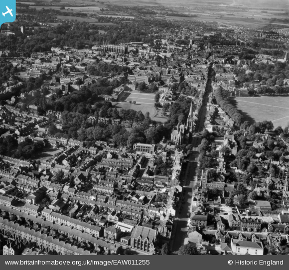
EAW011255 ENGLAND (1947). Regent Street, St Andrew's Street and the city, Cambridge, 1947
© Copyright OpenStreetMap contributors and licensed by the OpenStreetMap Foundation. 2025. Cartography is licensed as CC BY-SA.
Nearby Images (5)
Details
| Title | [EAW011255] Regent Street, St Andrew's Street and the city, Cambridge, 1947 |
| Reference | EAW011255 |
| Date | 30-September-1947 |
| Link | |
| Place name | CAMBRIDGE |
| Parish | |
| District | |
| Country | ENGLAND |
| Easting / Northing | 545418, 257745 |
| Longitude / Latitude | 0.12797642348894, 52.198328645262 |
| National Grid Reference | TL454577 |
Pins
 Class31 |
Wednesday 23rd of July 2014 03:23:09 PM | |
 Class31 |
Wednesday 23rd of July 2014 03:21:38 PM | |
 Class31 |
Wednesday 23rd of July 2014 03:20:19 PM | |
 Class31 |
Wednesday 23rd of July 2014 03:17:28 PM | |
 Class31 |
Wednesday 23rd of July 2014 03:16:00 PM | |
 john |
Sunday 8th of June 2014 04:43:06 PM | |
 john |
Sunday 8th of June 2014 04:42:06 PM | |
 john |
Sunday 8th of June 2014 04:39:51 PM | |
 john |
Sunday 8th of June 2014 04:36:27 PM | |
 john |
Sunday 8th of June 2014 04:33:52 PM | |
 john |
Sunday 8th of June 2014 04:31:53 PM | |
 innpictime |
Wednesday 6th of November 2013 12:04:33 PM |


![[EAW011255] Regent Street, St Andrew's Street and the city, Cambridge, 1947](http://britainfromabove.org.uk/sites/all/libraries/aerofilms-images/public/100x100/EAW/011/EAW011255.jpg)
![[EAW002921] Regent Street and the city centre, Cambridge, from the south-east, 1946](http://britainfromabove.org.uk/sites/all/libraries/aerofilms-images/public/100x100/EAW/002/EAW002921.jpg)
![[EPW059039] Parker's Piece, housing surrounding Coronation Street and the city centre, Cambridge, 1938](http://britainfromabove.org.uk/sites/all/libraries/aerofilms-images/public/100x100/EPW/059/EPW059039.jpg)
![[EPW025485] Downing College, Cambridge, 1928. This image has been produced from a copy-negative.](http://britainfromabove.org.uk/sites/all/libraries/aerofilms-images/public/100x100/EPW/025/EPW025485.jpg)
![[EAW011254] The city, Cambridge, from the south-east, 1947](http://britainfromabove.org.uk/sites/all/libraries/aerofilms-images/public/100x100/EAW/011/EAW011254.jpg)