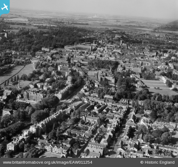
EAW011254 ENGLAND (1947). The city, Cambridge, from the south-east, 1947
© Copyright OpenStreetMap contributors and licensed by the OpenStreetMap Foundation. 2025. Cartography is licensed as CC BY-SA.
Nearby Images (6)
Details
| Title | [EAW011254] The city, Cambridge, from the south-east, 1947 |
| Reference | EAW011254 |
| Date | 30-September-1947 |
| Link | |
| Place name | CAMBRIDGE |
| Parish | |
| District | |
| Country | ENGLAND |
| Easting / Northing | 545208, 257601 |
| Longitude / Latitude | 0.12484394745236, 52.197090127549 |
| National Grid Reference | TL452576 |
Pins
 incony |
Sunday 19th of March 2023 11:12:12 AM | |
 john |
Sunday 8th of June 2014 06:22:01 PM |


![[EAW011254] The city, Cambridge, from the south-east, 1947](http://britainfromabove.org.uk/sites/all/libraries/aerofilms-images/public/100x100/EAW/011/EAW011254.jpg)
![[EPW025480] The city, Cambridge, from the south-west, 1928. This image has been produced from a copy-negative.](http://britainfromabove.org.uk/sites/all/libraries/aerofilms-images/public/100x100/EPW/025/EPW025480.jpg)
![[EPW000052] Scroope House and The Leys School, Cambridge, 1920](http://britainfromabove.org.uk/sites/all/libraries/aerofilms-images/public/100x100/EPW/000/EPW000052.jpg)
![[EPW059040] Trumpington Street, Addenbrooke's Hospital and environs, Cambridge, 1938. This image has been produced from a copy-negative.](http://britainfromabove.org.uk/sites/all/libraries/aerofilms-images/public/100x100/EPW/059/EPW059040.jpg)
![[EAW002928] A rugby match being played on Leys School Sports Ground, Cambridge, 1946](http://britainfromabove.org.uk/sites/all/libraries/aerofilms-images/public/100x100/EAW/002/EAW002928.jpg)
![[EAW011255] Regent Street, St Andrew's Street and the city, Cambridge, 1947](http://britainfromabove.org.uk/sites/all/libraries/aerofilms-images/public/100x100/EAW/011/EAW011255.jpg)
