
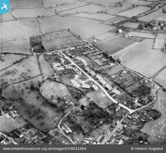
EAW011984 ENGLAND (1947). Houses along Ridgeway, Nailsea, 1947
© Copyright OpenStreetMap contributors and licensed by the OpenStreetMap Foundation. 2025. Cartography is licensed as CC BY-SA.
Nearby Images (11)
EAW011984

EAW011981

EAW011979

EAW011982

EAW011980

EAW011983

EAW011978

EAW011985

EAW011975

EAW011977

EAW011976

Details
| Title | [EAW011984] Houses along Ridgeway, Nailsea, 1947 |
| Reference | EAW011984 |
| Date | 1-November-1947 |
| Link | |
| Place name | NAILSEA |
| Parish | NAILSEA |
| District | |
| Country | ENGLAND |
| Easting / Northing | 346460, 170371 |
| Longitude / Latitude | -2.7702165335306, 51.429319579978 |
| National Grid Reference | ST465704 |
Pins
Be the first to add a comment to this image!