
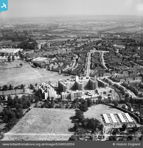
EAW018359 ENGLAND (1948). St Helier Hospital and environs, St Helier, from the south-west, 1948. This image was marked by Aerofilms Ltd for photo editing.
© Copyright OpenStreetMap contributors and licensed by the OpenStreetMap Foundation. 2025. Cartography is licensed as CC BY-SA.
Nearby Images (15)
EAW018359

EPW062016

EPW062018

EPW062017

EPW062014

EAW018364

EPW062015

EAW018362

EPW062012

EAW018363

EPW062013

EAW018360

EAW018357

EAW018361

EAW018358

Details
| Title | [EAW018359] St Helier Hospital and environs, St Helier, from the south-west, 1948. This image was marked by Aerofilms Ltd for photo editing. |
| Reference | EAW018359 |
| Date | 27-August-1948 |
| Link | |
| Place name | ST HELIER |
| Parish | |
| District | |
| Country | ENGLAND |
| Easting / Northing | 526411, 166075 |
| Longitude / Latitude | -0.18340919536997, 51.379135603534 |
| National Grid Reference | TQ264661 |
Pins
 Mark1973 |
Thursday 8th of June 2017 09:13:02 PM | |
Mark1973 |
Thursday 8th of June 2017 09:11:18 PM | |
Mark1973 |
Thursday 8th of June 2017 09:09:49 PM | |
Mark1973 |
Thursday 8th of June 2017 09:08:54 PM | |
Mark1973 |
Thursday 8th of June 2017 09:07:52 PM | |
Mark1973 |
Thursday 8th of June 2017 09:06:17 PM | |
Mark1973 |
Thursday 8th of June 2017 09:05:23 PM | |
Mark1973 |
Thursday 8th of June 2017 09:04:38 PM | |
steve |
Friday 12th of September 2014 12:03:05 PM |