
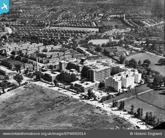
EPW062014 ENGLAND (1939). St Helier Hospital under construction, St Helier, 1939
© Copyright OpenStreetMap contributors and licensed by the OpenStreetMap Foundation. 2025. Cartography is licensed as CC BY-SA.
Nearby Images (15)
EPW062014

EAW018360

EPW062013

EAW018362

EPW062012

EPW062018

EPW062017

EPW062015

EPW062016

EAW018364

EAW018359

EAW018361

EAW018357

EAW018363

EAW018358

Details
| Title | [EPW062014] St Helier Hospital under construction, St Helier, 1939 |
| Reference | EPW062014 |
| Date | 27-June-1939 |
| Link | |
| Place name | ST HELIER |
| Parish | |
| District | |
| Country | ENGLAND |
| Easting / Northing | 526455, 166134 |
| Longitude / Latitude | -0.18275622849128, 51.379656103746 |
| National Grid Reference | TQ265661 |
Pins
 stack1378 |
Sunday 31st of May 2020 06:54:34 PM | |
Hicksy |
Sunday 29th of December 2013 11:51:00 AM | |
AndyB |
Friday 27th of December 2013 07:24:15 PM | |
christhewino |
Friday 11th of October 2013 07:54:08 PM | |
christhewino |
Friday 11th of October 2013 07:47:16 PM | |
christhewino |
Thursday 10th of October 2013 09:52:32 PM | |
christhewino |
Tuesday 8th of October 2013 07:58:48 PM | |
christhewino |
Tuesday 8th of October 2013 07:58:04 PM | |
christhewino |
Tuesday 8th of October 2013 07:57:43 PM | |
christhewino |
Tuesday 8th of October 2013 07:56:31 PM |