
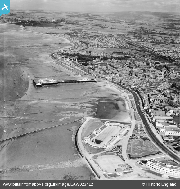
EAW023412 ENGLAND (1949). The seafront from Shell Bed Flat towards Scalestones Point, Morecombe, from the west, 1949
© Copyright OpenStreetMap contributors and licensed by the OpenStreetMap Foundation. 2025. Cartography is licensed as CC BY-SA.
Nearby Images (10)
EAW023412

EAW026226

EPW042138

EPW004078

EPW042133

EPW004072

EPW042139

EPR000309

EPR000308

EPW004079

Details
| Title | [EAW023412] The seafront from Shell Bed Flat towards Scalestones Point, Morecombe, from the west, 1949 |
| Reference | EAW023412 |
| Date | 25-May-1949 |
| Link | |
| Place name | MORECOMBE |
| Parish | MORECAMBE |
| District | |
| Country | ENGLAND |
| Easting / Northing | 342966, 464540 |
| Longitude / Latitude | -2.8717195431725, 54.073445904025 |
| National Grid Reference | SD430645 |
Pins
 Matt Aldred edob.mattaldred.com |
Tuesday 9th of March 2021 01:56:53 PM | |
 redmist |
Saturday 5th of December 2020 09:37:03 PM | |
redmist |
Saturday 5th of December 2020 09:36:13 PM | |
cptpies |
Friday 21st of December 2018 11:52:07 AM |