
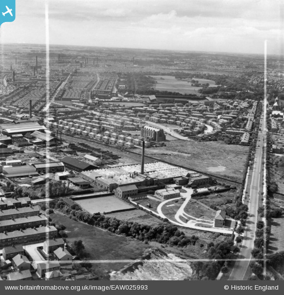
EAW025993 ENGLAND (1949). Emerson Mill, Blackpool Road and environs, Preston, from the east, 1949. This image has been produced from a print marked by Aerofilms Ltd for photo editing.
© Copyright OpenStreetMap contributors and licensed by the OpenStreetMap Foundation. 2025. Cartography is licensed as CC BY-SA.
Nearby Images (22)
EAW025993

EPW026293

EAW025996

EPW026296

EPW026291

EPW026295

EPW026292

EPW026399

EPW056720

EAW025997

EPW056721

EPW056723

EPW056724

EPW056725

EPW026294

EPW056722

EAW025994

EAW025995

EAW025999

EAW025998

EPW038861

EPW038860

Details
| Title | [EAW025993] Emerson Mill, Blackpool Road and environs, Preston, from the east, 1949. This image has been produced from a print marked by Aerofilms Ltd for photo editing. |
| Reference | EAW025993 |
| Date | 13-August-1949 |
| Link | |
| Place name | PRESTON |
| Parish | |
| District | |
| Country | ENGLAND |
| Easting / Northing | 355579, 430709 |
| Longitude / Latitude | -2.6740404666018, 53.770608461986 |
| National Grid Reference | SD556307 |
Pins
Be the first to add a comment to this image!