
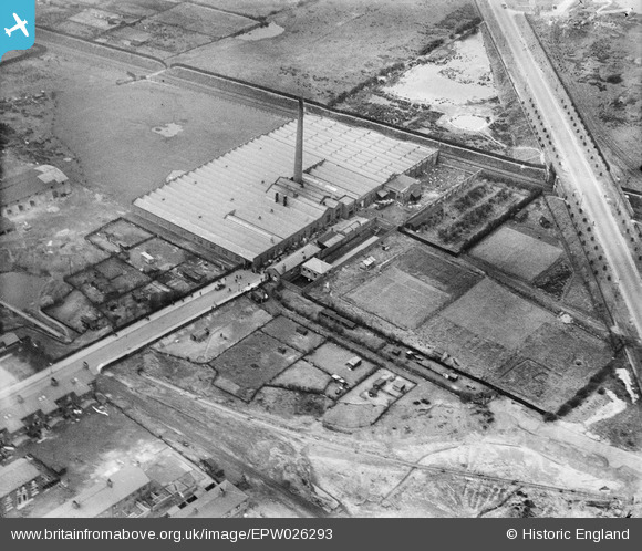
EPW026293 ENGLAND (1929). The Emerson Cotton Mill, Preston, 1929
© Copyright OpenStreetMap contributors and licensed by the OpenStreetMap Foundation. 2025. Cartography is licensed as CC BY-SA.
Nearby Images (26)
EPW026293

EPW026291

EPW026296

EPW026295

EPW026292

EPW056720

EAW025997

EPW056721

EPW026399

EPW056723

EPW056724

EPW056725

EAW025993

EAW025996

EPW026294

EPW056722

EAW025994

EAW025999

EPW038861

EAW025995

EAW025998

EPW038860

EPW038859

EPW038858

EPW038866

EPW038862

Details
| Title | [EPW026293] The Emerson Cotton Mill, Preston, 1929 |
| Reference | EPW026293 |
| Date | April-1929 |
| Link | |
| Place name | PRESTON |
| Parish | |
| District | |
| Country | ENGLAND |
| Easting / Northing | 355519, 430715 |
| Longitude / Latitude | -2.6749516970991, 53.770657271024 |
| National Grid Reference | SD555307 |
