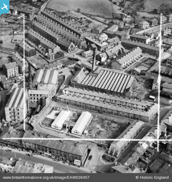
EAW028457 ENGLAND (1950). Higher Mill, Rawtenstall, 1950. This image was marked by Aerofilms Ltd for photo editing.
© Copyright OpenStreetMap contributors and licensed by the OpenStreetMap Foundation. 2025. Cartography is licensed as CC BY-SA.
Nearby Images (7)
Details
| Title | [EAW028457] Higher Mill, Rawtenstall, 1950. This image was marked by Aerofilms Ltd for photo editing. |
| Reference | EAW028457 |
| Date | 25-March-1950 |
| Link | |
| Place name | RAWTENSTALL |
| Parish | |
| District | |
| Country | ENGLAND |
| Easting / Northing | 381391, 423073 |
| Longitude / Latitude | -2.2819205365802, 53.70353064908 |
| National Grid Reference | SD814231 |
Pins
Be the first to add a comment to this image!


![[EAW028457] Higher Mill, Rawtenstall, 1950. This image was marked by Aerofilms Ltd for photo editing.](http://britainfromabove.org.uk/sites/all/libraries/aerofilms-images/public/100x100/EAW/028/EAW028457.jpg)
![[EAW028455] Higher Mill, Rawtenstall, 1950. This image was marked by Aerofilms Ltd for photo editing.](http://britainfromabove.org.uk/sites/all/libraries/aerofilms-images/public/100x100/EAW/028/EAW028455.jpg)
![[EAW028456] Higher Mill, Rawtenstall, 1950. This image was marked by Aerofilms Ltd for photo editing.](http://britainfromabove.org.uk/sites/all/libraries/aerofilms-images/public/100x100/EAW/028/EAW028456.jpg)
![[EAW028458] Higher Mill, Rawtenstall, 1950. This image was marked by Aerofilms Ltd for photo editing.](http://britainfromabove.org.uk/sites/all/libraries/aerofilms-images/public/100x100/EAW/028/EAW028458.jpg)
![[EAW028452] Higher Mill, Rawtenstall, 1950. This image was marked by Aerofilms Ltd for photo editing.](http://britainfromabove.org.uk/sites/all/libraries/aerofilms-images/public/100x100/EAW/028/EAW028452.jpg)
![[EAW028453] Higher Mill, Rawtenstall, 1950. This image was marked by Aerofilms Ltd for photo editing.](http://britainfromabove.org.uk/sites/all/libraries/aerofilms-images/public/100x100/EAW/028/EAW028453.jpg)
![[EAW028454] Higher Mill, Rawtenstall, 1950. This image was marked by Aerofilms Ltd for photo editing.](http://britainfromabove.org.uk/sites/all/libraries/aerofilms-images/public/100x100/EAW/028/EAW028454.jpg)