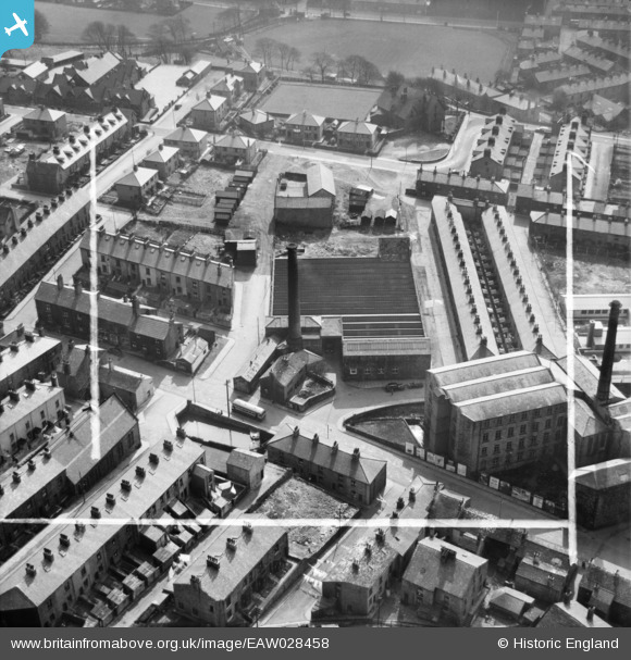
EAW028458 ENGLAND (1950). Higher Mill, Rawtenstall, 1950. This image was marked by Aerofilms Ltd for photo editing.
© Copyright OpenStreetMap contributors and licensed by the OpenStreetMap Foundation. 2025. Cartography is licensed as CC BY-SA.
Nearby Images (7)
Details
| Title | [EAW028458] Higher Mill, Rawtenstall, 1950. This image was marked by Aerofilms Ltd for photo editing. |
| Reference | EAW028458 |
| Date | 25-March-1950 |
| Link | |
| Place name | RAWTENSTALL |
| Parish | |
| District | |
| Country | ENGLAND |
| Easting / Northing | 381418, 423080 |
| Longitude / Latitude | -2.2815119203937, 53.703594534207 |
| National Grid Reference | SD814231 |
Pins
 Ralph Pomeroy |
Monday 23rd of December 2019 04:00:20 PM | |
 Ralph Pomeroy |
Monday 23rd of December 2019 03:59:42 PM | |
 wadey |
Wednesday 1st of October 2014 10:48:45 PM | |
 wadey |
Wednesday 1st of October 2014 10:48:03 PM | |
 wadey |
Wednesday 1st of October 2014 10:47:23 PM | |
 wadey |
Wednesday 1st of October 2014 10:46:02 PM | |
 wadey |
Wednesday 1st of October 2014 10:44:37 PM | |
 wadey |
Wednesday 1st of October 2014 10:44:00 PM | |
 wadey |
Wednesday 1st of October 2014 10:42:59 PM | |
 wadey |
Wednesday 1st of October 2014 10:42:30 PM | |
 wadey |
Wednesday 1st of October 2014 10:41:42 PM | |
 wadey |
Wednesday 1st of October 2014 10:40:58 PM |


![[EAW028458] Higher Mill, Rawtenstall, 1950. This image was marked by Aerofilms Ltd for photo editing.](http://britainfromabove.org.uk/sites/all/libraries/aerofilms-images/public/100x100/EAW/028/EAW028458.jpg)
![[EAW028452] Higher Mill, Rawtenstall, 1950. This image was marked by Aerofilms Ltd for photo editing.](http://britainfromabove.org.uk/sites/all/libraries/aerofilms-images/public/100x100/EAW/028/EAW028452.jpg)
![[EAW028456] Higher Mill, Rawtenstall, 1950. This image was marked by Aerofilms Ltd for photo editing.](http://britainfromabove.org.uk/sites/all/libraries/aerofilms-images/public/100x100/EAW/028/EAW028456.jpg)
![[EAW028453] Higher Mill, Rawtenstall, 1950. This image was marked by Aerofilms Ltd for photo editing.](http://britainfromabove.org.uk/sites/all/libraries/aerofilms-images/public/100x100/EAW/028/EAW028453.jpg)
![[EAW028455] Higher Mill, Rawtenstall, 1950. This image was marked by Aerofilms Ltd for photo editing.](http://britainfromabove.org.uk/sites/all/libraries/aerofilms-images/public/100x100/EAW/028/EAW028455.jpg)
![[EAW028457] Higher Mill, Rawtenstall, 1950. This image was marked by Aerofilms Ltd for photo editing.](http://britainfromabove.org.uk/sites/all/libraries/aerofilms-images/public/100x100/EAW/028/EAW028457.jpg)
![[EAW028454] Higher Mill, Rawtenstall, 1950. This image was marked by Aerofilms Ltd for photo editing.](http://britainfromabove.org.uk/sites/all/libraries/aerofilms-images/public/100x100/EAW/028/EAW028454.jpg)