
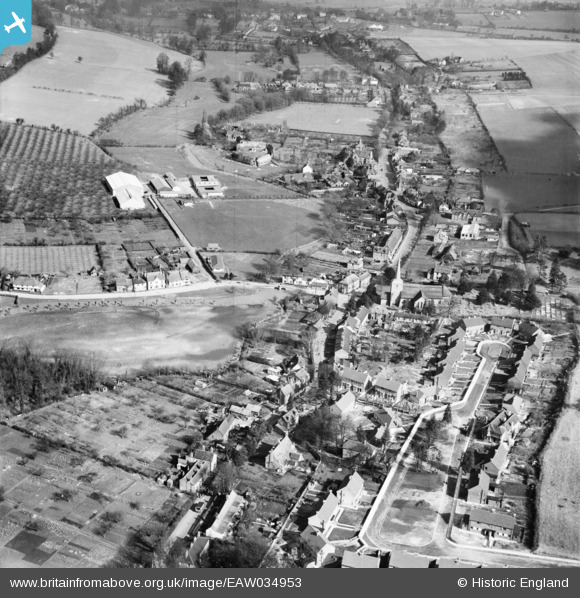
EAW034953 ENGLAND (1951). The village, Eynsford, 1951
© Copyright OpenStreetMap contributors and licensed by the OpenStreetMap Foundation. 2025. Cartography is licensed as CC BY-SA.
Nearby Images (16)
EAW034953

EAW034956

EAW029124

EAW023110

EAW029112

EAW029111

EAW029110

EAW029125

EAW029109

EAW023111

EAW029113

EAW029120

EAW029126

EAW013377

EAW029118

EAW029123

Details
| Title | [EAW034953] The village, Eynsford, 1951 |
| Reference | EAW034953 |
| Date | 15-March-1951 |
| Link | |
| Place name | EYNSFORD |
| Parish | EYNSFORD |
| District | |
| Country | ENGLAND |
| Easting / Northing | 554009, 165539 |
| Longitude / Latitude | 0.21266663443781, 51.367502457749 |
| National Grid Reference | TQ540655 |
Pins
Be the first to add a comment to this image!