
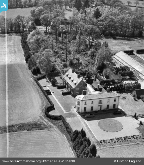
EAW035830 ENGLAND (1951). Landhurst, Hartfield, 1951. This image has been produced from a print marked by Aerofilms Ltd for photo editing.
© Copyright OpenStreetMap contributors and licensed by the OpenStreetMap Foundation. 2025. Cartography is licensed as CC BY-SA.
Nearby Images (13)
EAW035830

EAW036345

EAW036346

EAW036347

EAW036348

EAW036349

EAW035826

EAW035827

EAW036350

EAW035829

EAW036352

EAW036351

EAW035828

Details
| Title | [EAW035830] Landhurst, Hartfield, 1951. This image has been produced from a print marked by Aerofilms Ltd for photo editing. |
| Reference | EAW035830 |
| Date | 12-May-1951 |
| Link | |
| Place name | HARTFIELD |
| Parish | HARTFIELD |
| District | |
| Country | ENGLAND |
| Easting / Northing | 547354, 134805 |
| Longitude / Latitude | 0.10448290452659, 51.093067800372 |
| National Grid Reference | TQ474348 |
Pins
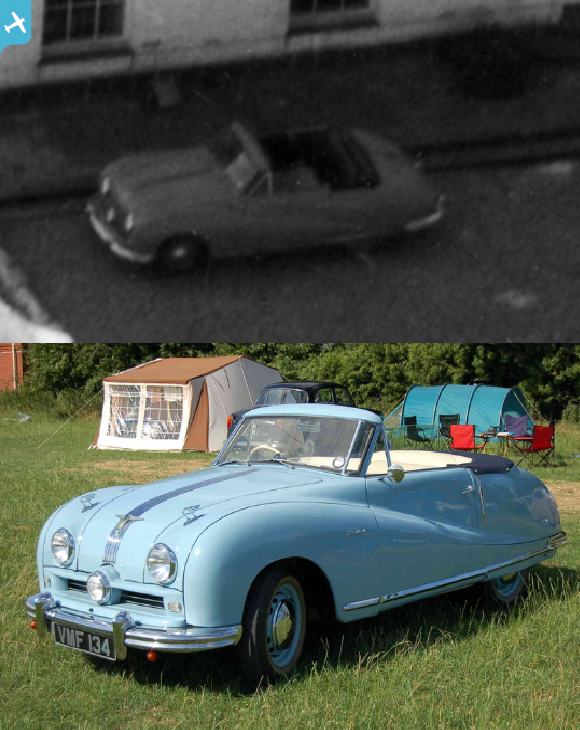 |
 Billy Turner |
Friday 30th of September 2016 03:18:26 PM |