
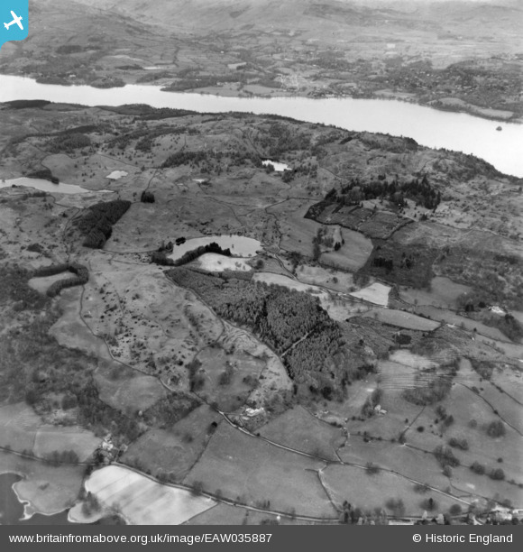
EAW035887 ENGLAND (1951). High Broad How, Moss Eccles Tarn and surrounding countryside, Near Sawrey, 1951. This image has been produced from a print.
© Copyright OpenStreetMap contributors and licensed by the OpenStreetMap Foundation. 2025. Cartography is licensed as CC BY-SA.
Nearby Images (3)
EAW035887

EAW046945

EAW037152

Details
| Title | [EAW035887] High Broad How, Moss Eccles Tarn and surrounding countryside, Near Sawrey, 1951. This image has been produced from a print. |
| Reference | EAW035887 |
| Date | 13-May-1951 |
| Link | |
| Place name | NEAR SAWREY |
| Parish | CLAIFE |
| District | |
| Country | ENGLAND |
| Easting / Northing | 337221, 496725 |
| Longitude / Latitude | -2.966243763116, 54.362027958025 |
| National Grid Reference | SD372967 |
Pins
Be the first to add a comment to this image!