
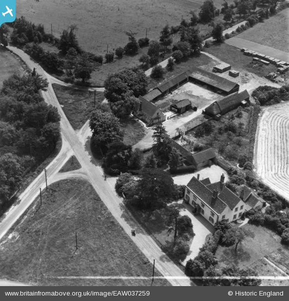
EAW037259 ENGLAND (1951). Maypole Farm, Maypole Green, 1951. This image has been produced from a print marked by Aerofilms Ltd for photo editing.
© Copyright OpenStreetMap contributors and licensed by the OpenStreetMap Foundation. 2025. Cartography is licensed as CC BY-SA.
Nearby Images (3)
EAW037259

EAW037260

EAW037263

Details
| Title | [EAW037259] Maypole Farm, Maypole Green, 1951. This image has been produced from a print marked by Aerofilms Ltd for photo editing. |
| Reference | EAW037259 |
| Date | 21-June-1951 |
| Link | |
| Place name | MAYPOLE GREEN |
| Parish | |
| District | |
| Country | ENGLAND |
| Easting / Northing | 598614, 221932 |
| Longitude / Latitude | 0.88470128039992, 51.860126228661 |
| National Grid Reference | TL986219 |
Pins
 |
 keithb |
Sunday 22nd of March 2015 06:49:56 PM |