
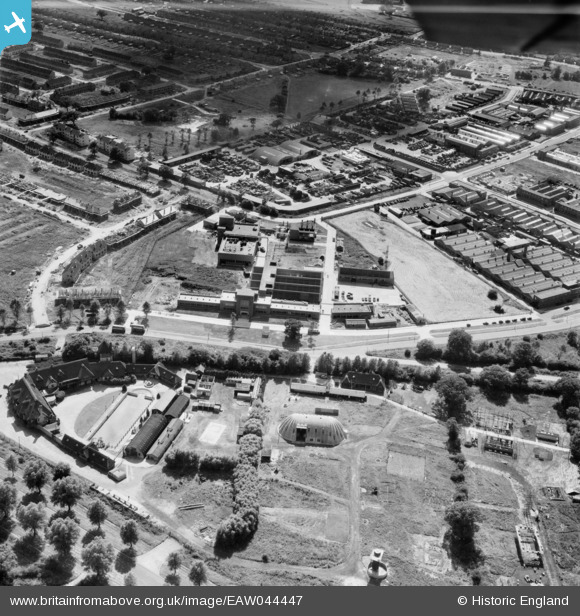
EAW044447 ENGLAND (1952). The Thatched Barn roadhouse and industrial premises between Elstree Way and Chester Road, Borehamwood, 1952
© Copyright OpenStreetMap contributors and licensed by the OpenStreetMap Foundation. 2025. Cartography is licensed as CC BY-SA.
Nearby Images (11)
EAW044447

EAW044445

EAW044446

EAW044305

EPW046583

EAW031642

EPW046584

EAW031644

EAW031634

EAW031638

EAW041408

Details
| Title | [EAW044447] The Thatched Barn roadhouse and industrial premises between Elstree Way and Chester Road, Borehamwood, 1952 |
| Reference | EAW044447 |
| Date | 27-June-1952 |
| Link | |
| Place name | BOREHAMWOOD |
| Parish | ELSTREE AND BOREHAMWOOD |
| District | |
| Country | ENGLAND |
| Easting / Northing | 520981, 196812 |
| Longitude / Latitude | -0.25084750190139, 51.656592724482 |
| National Grid Reference | TQ210968 |
Pins
 NthLondonBoy |
Friday 19th of December 2014 05:44:16 PM | |
NthLondonBoy |
Friday 19th of December 2014 05:40:37 PM | |
NthLondonBoy |
Friday 19th of December 2014 05:39:58 PM | |
mc52 |
Tuesday 8th of July 2014 07:50:12 PM | |
mc52 |
Monday 7th of July 2014 06:04:19 PM |