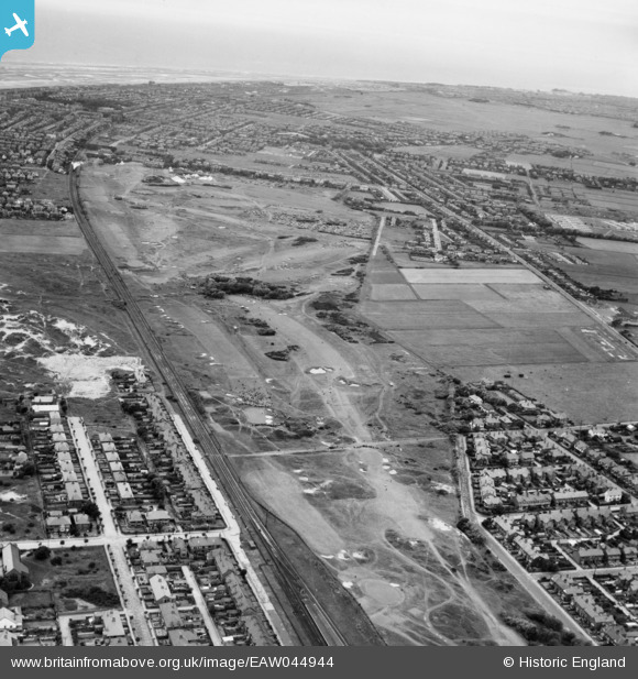
EAW044944 ENGLAND (1952). Lytham St Anne's, the 1952 Open Golf Championship (9-11 July) in progress at Royal Lytham St Anne's Golf Course, from the south-east, 1952
© Copyright OpenStreetMap contributors and licensed by the OpenStreetMap Foundation. 2025. Cartography is licensed as CC BY-SA.
Details
| Title | [EAW044944] Lytham St Anne's, the 1952 Open Golf Championship (9-11 July) in progress at Royal Lytham St Anne's Golf Course, from the south-east, 1952 |
| Reference | EAW044944 |
| Date | July-1952 |
| Link | |
| Place name | LYTHAM ST ANNE'S |
| Parish | SAINT ANNE'S ON THE SEA |
| District | |
| Country | ENGLAND |
| Easting / Northing | 334239, 427961 |
| Longitude / Latitude | -2.9972212641437, 53.743652761781 |
| National Grid Reference | SD342280 |
Pins
 redmist |
Tuesday 6th of October 2020 04:58:04 PM | |
 redmist |
Wednesday 20th of March 2019 11:47:19 AM | |
 Graham Yaxley |
Monday 9th of February 2015 02:18:03 PM |
User Comment Contributions
This years Championship was won by South African Bobby Locke with a score of 287 (1 under par) for which he received the princely sum of £300. |
 mannidaze |
Saturday 15th of November 2014 07:24:17 PM |


![[EAW044944] Lytham St Anne's, the 1952 Open Golf Championship (9-11 July) in progress at Royal Lytham St Anne's Golf Course, from the south-east, 1952](http://britainfromabove.org.uk/sites/all/libraries/aerofilms-images/public/100x100/EAW/044/EAW044944.jpg)
![[EAW044945] Lytham St Anne's, the 1952 Open Golf Championship (9-11 July) in progress at Royal Lytham St Anne's Golf Course, from the south-east, 1952](http://britainfromabove.org.uk/sites/all/libraries/aerofilms-images/public/100x100/EAW/044/EAW044945.jpg)
![[EAW044946] Lytham St Anne's, the 1952 Open Golf Championship (9-11 July) in progress at Royal Lytham St Anne's Golf Course, 1952](http://britainfromabove.org.uk/sites/all/libraries/aerofilms-images/public/100x100/EAW/044/EAW044946.jpg)