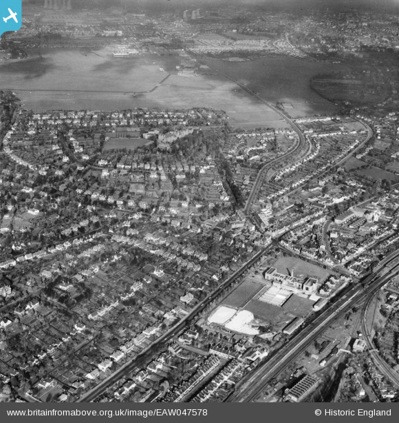
EAW047578 ENGLAND (1952). Foxley Lane and environs, Purley, 1952
© Copyright OpenStreetMap contributors and licensed by the OpenStreetMap Foundation. 2024. Cartography is licensed as CC BY-SA.
Details
| Title | [EAW047578] Foxley Lane and environs, Purley, 1952 |
| Reference | EAW047578 |
| Date | 23-October-1952 |
| Link | |
| Place name | PURLEY |
| Parish | |
| District | |
| Country | ENGLAND |
| Easting / Northing | 531129, 161783 |
| Longitude / Latitude | -0.11723047988181, 51.339489314371 |
| National Grid Reference | TQ311618 |
Pins
 James Cullen |
Friday 6th of September 2024 02:13:47 PM | |
 brianbeckett |
Saturday 18th of October 2014 09:31:23 PM | |
 Tony74 |
Tuesday 14th of October 2014 06:18:44 PM | |
 Tony74 |
Tuesday 14th of October 2014 06:17:56 PM | |
 Tony74 |
Tuesday 14th of October 2014 06:10:46 PM | |
 Tony74 |
Tuesday 14th of October 2014 06:10:28 PM | |
 brianbeckett |
Saturday 4th of October 2014 12:53:21 PM | |
 brianbeckett |
Wednesday 24th of September 2014 02:26:21 PM | |
 longshot |
Saturday 26th of July 2014 10:15:28 PM | |
 longshot |
Saturday 26th of July 2014 10:13:59 PM |


![[EAW047578] Foxley Lane and environs, Purley, 1952](http://britainfromabove.org.uk/sites/all/libraries/aerofilms-images/public/100x100/EAW/047/EAW047578.jpg)
![[EAW047577] Purley Railway Station and environs, Purley, 1952](http://britainfromabove.org.uk/sites/all/libraries/aerofilms-images/public/100x100/EAW/047/EAW047577.jpg)